Construction Drone Photography & Video
Construction Drone Photography & Video
Drone photography is revolutionizing the construction industry by providing detailed aerial perspectives that enhance project management, improve safety, and ensure cost efficiency. Employing unmanned aerial vehicles (UAVs), construction drone photography offers a bird’s-eye view that is indispensable for large-scale projects.
Featured Clients

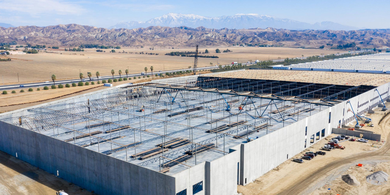
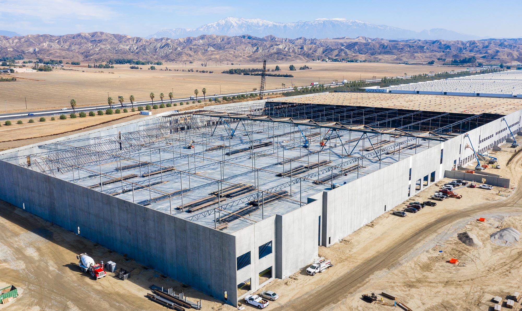
AeroViews was contracted by Skechers Inc, one of California’s most successful corporations, to document the building of an additional 1.2M square foot, state of the art facility in Moreno Valley, CA. The drone pilot and owner David DeLeon worked exclusively with the Skechers executive team to deliver the project scope which included 18 months of drone photos & video, interior photos and a fully produced drone video to celebrate the first wall being lifted.

AeroViews was contracted by Quidel, a California-based leading diagnostic healthcare manufacturer, to shoot their headquarters and 4 other locations spanning throughout San Diego county. The scope of work included detailed photos of rooftop construction, panoramas, and over 80 large format printed foam boards.

AeroViews was contracted by Moon Valley Nurseries, the most popular nursery on the West Coast that provides trees and plants to thousands of homeowners and landscape designers throughout Southern California. AeroViews was hired to gather footage from a 350K+ landscape project from beginning to end. The project scope included drone photos and video, ground photos and video, timelapse footage and more.

Rayco has been operating for 9+ years and has worked on a combined total of more than 3,500 homes, commercial buildings, HOA communities and complexes in Southern California. AeroViews is currently under contract with Rayco Exteriors to shoot 6 locations monthly in San Diego & Orange County.
Introduction to Construction Drone Photography
Drone photography in construction involves the use of unmanned aerial vehicles (UAVs) to capture aerial images and videos that provide invaluable data for project managers, engineers, and stakeholders. A key component of this drone technology is aerial imagery, which plays a crucial role in capturing high-definition photos and videos for effective project management and planning. This technology allows for real-time monitoring of projects, aiding in more accurate planning, enhanced communication, and improved project documentation.
Benefits of Drone Photography in Construction
- Enhanced Project Monitoring and Progress Tracking: Drones not only offer a bird’s-eye view, making it easier to oversee a large construction project, but they also facilitate real-time monitoring of progress, ensuring that the project is advancing as planned and highlighting completed work through aerial imagery.
- Increased Accuracy and Data Collection: With high-resolution images and the ability to access hard-to-reach areas, drones not only help detect issues before they become costly problems but also gather data comprehensively for a construction project, elevating businesses with detailed imagery and coverage.
- Improved Safety: By using drones, site managers can reduce the need for manual site inspections, minimizing risks associated with construction work.
- Cost Efficiency: Drone photography can significantly reduce the time and labor needed for site surveys and inspections, translating into cost savings.
- Better Documentation: Drones provide detailed records of construction progress, useful for both current analysis and future reference.
Real-World Applications of Drone Photography in Construction
Illustrative examples and case studies demonstrate the practical benefits of drone photography:
- Site Planning and Design: Drones can capture topographic data that is essential for accurate site planning and 3D modeling. Aerial photos are crucial for capturing comprehensive views of the site, offering insights from angles and perspectives unseen from the ground.
- Progress Tracking: Regular drone flights provide visual progress reports that help keep projects on schedule. Drone photos play a pivotal role in providing detailed visual reports of construction progress, showcasing the entire project from unique aerial perspectives.
- Inspection and Maintenance: Drones can inspect structures for maintenance needs without the need for scaffolding or cranes.
What are the benefits of using drone photography in construction projects?
Drone photography offers numerous benefits for a construction project, revolutionizing the way these projects are managed and executed. Firstly, it provides a unique aerial perspective that is invaluable for precise site surveying and mapping. This bird’s-eye view allows for accurate monitoring of project progress and helps in identifying potential issues before they escalate, saving time and reducing costs. Secondly, drone photography enhances site safety by minimizing the need for personnel to physically access potentially dangerous or difficult-to-reach areas. Additionally, the high-resolution images and videos captured by drones are crucial for creating detailed records and documentation, improving communication and transparency among project stakeholders. By enabling frequent and comprehensive site assessments, drone photography ensures that construction projects adhere strictly to their timelines and budgets, making it an indispensable tool in modern construction management.
How does drone photography enhance safety on construction sites?
Construction drone photography significantly enhances safety on construction sites by reducing the need for manual inspections in hazardous or hard-to-reach areas. By deploying drones, site managers can obtain comprehensive visual data without exposing workers to potential risks associated with heights, unstable structures, or heavy machinery. Drone technology can quickly and safely survey large areas, providing real-time feedback that helps in promptly addressing safety concerns and ensuring compliance with safety regulations on the construction site.
What types of drones are best suited for construction photography?
The best drones for construction drone photography are typically those equipped with high-resolution cameras and robust stabilization features that can deliver clear, detailed aerial images even in challenging conditions. Drones like the DJI Mavic 3 Pro or the DJI Inspire series are popular choices because they offer both advanced imaging capabilities and durable designs suited for the construction environment. Features such as GPS positioning and the ability to carry multiple sensors are also crucial for capturing diverse data types required on construction sites.
Are there legal requirements for using drones on construction sites?
Yes, there are specific legal requirements for using construction drone photography, which vary by region. In many countries, operators must obtain a commercial drone license from the relevant aviation authority, along with specific permissions to fly in controlled airspace or near sensitive areas. It’s essential to comply with these regulations, which might include flight height restrictions, insurance mandates, and privacy considerations, to ensure that drone operations are both legal and safe on a construction site.
How accurate is the data collected from construction drone photography?
The data collected from construction drone photography is highly accurate, often providing precision that is vital for effective construction management. Drones equipped with GPS and advanced imaging technologies can capture minute details of a construction site, allowing for measurements that are precise enough for critical tasks such as surveying land or inspecting buildings. This accuracy helps in making informed decisions, ensuring quality control, and planning future steps efficiently.
Can drone photography be used for mapping and surveys in construction?
Absolutely, construction drone photography is increasingly being used for mapping and surveys due to its efficiency and accuracy. Drones can cover large areas quickly, providing detailed topographical maps that are essential for the planning and design phase of construction projects. They are particularly useful in capturing data from inaccessible areas, and the images can be integrated into Geographic Information Systems (GIS) for further analysis and detailed site planning of a construction site.
What is the cost of implementing drone photos in a construction project?
The cost of implementing construction drone photography varies depending on several factors, including the scope of the project, the type of drone used, and whether the service is outsourced or managed internally. Initial costs may include the purchase of the drone, training for operators, and necessary insurance. However, the investment can lead to significant cost savings over time through improved efficiency, reduced need for manual labor, and decreased risk of costly errors and reworks.
How often should drone photography be conducted during a construction project?
The frequency of construction drone photography depends on the project’s complexity and timeline. For dynamic construction sites, aerial surveys might be conducted weekly or even daily to track progress and identify any deviations from plans. For less active or smaller-scale projects, less frequent monitoring may be sufficient. It’s important to tailor the drone usage schedule to the specific needs of each project for optimal efficiency and cost-effectiveness.
What qualifications should a drone operator have for construction photography?
A drone operator involved in construction drone photography should have specific qualifications that typically include a certification or license from a recognized aviation authority, such as the FAA in the United States. Additionally, operators should have training in aerial photography and drone navigation, particularly in a construction setting. Knowledge of safety protocols and local regulations is also essential to ensure that drone operations are both safe and compliant with legal standards.
How can construction companies integrate drone photography data into their existing systems?
Construction companies can integrate aerial imagery data into their existing systems by using specialized software that supports image processing and data analysis. This integration often involves Geographic Information Systems (GIS), Building Information Modeling (BIM), and other project management tools that can utilize aerial images for enhanced visualization and planning. Effective data integration allows for seamless communication between various departments, enhancing the overall workflow and efficiency of construction projects.
What is construction progress monitoring?
Construction progress monitoring is the systematic process of tracking the advancement of a construction site to ensure it adheres to the timeline, budget, and specified standards. It involves regular inspections and reporting to identify any deviations or delays that might affect the project.
What tools are used to monitor construction progress?
Tools commonly used for monitoring construction progress include project management software, drones for aerial photography and video, time-lapse cameras, and various reporting and documentation tools that help track and record progress against the construction site.
Can construction progress monitoring help in cost management?
Yes, effective construction progress monitoring plays a critical role in cost management by identifying potential issues early, which can prevent costly fees to the construction site.
How can technology improve construction progress tracking?
Technology can significantly enhance construction progress tracking through real-time data collection, automated reports, and improved communication among team members. Tools like Building Information Modeling (BIM), drones, and project management software enable more accurate and timely insights into project status.
What are the benefits of using drones for construction progress monitoring?
Drones provide a unique aerial viewpoint that is invaluable for tracking construction progress. They offer safe, efficient, and cost-effective ways to capture detailed and up-to-date images of the construction site, helping project managers identify issues quickly and make informed decisions.
How do construction drone services improve project efficiency?
Drone services improve project efficiency by providing rapid, accurate visual data that helps project managers make informed decisions quickly. Drones can survey a construction site in a fraction of the time it takes with traditional methods, offering real-time insights into project status, which facilitates faster adjustments and reduces downtime.
- Federal Aviation Administration (FAA) – Unmanned Aircraft Systems: This official page offers comprehensive guidelines and regulations for drone operations in the United States, which is crucial for ensuring legal compliance in drone usage for construction or any other commercial purposes. FAA Unmanned Aircraft Systems
- Commercial UAV News – Construction: This resource provides industry-specific news, case studies, and analysis on the use of unmanned aerial vehicles (UAVs) in construction. It’s an excellent source for staying updated on the latest trends, technologies, and best practices in drone usage within the construction sector. Commercial UAV News – Construction


