Malibu Drone Services
Malibu Drone Services
From coastal estates and hillside properties to construction sites and infrastructure corridors, AeroViews provides FAA-certified drone services across Malibu, California. We specialize in aerial mapping, LiDAR surveying, 3D modeling, and high-resolution drone imaging for commercial and residential projects.


Malibu Drone Photography, Mapping & LiDAR Services
AeroViews provides professional drone photography, mapping, and LiDAR imaging throughout Malibu, CA, capturing one of California’s most iconic coastlines with precision and artistry. Our FAA-certified pilots deliver cinematic aerial visuals and survey-grade geospatial data for real estate, construction, and environmental projects.
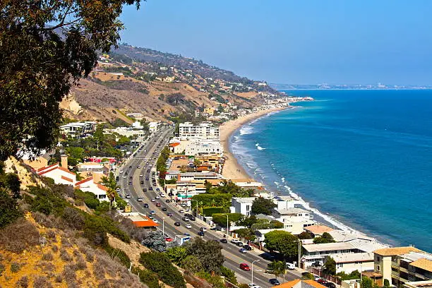
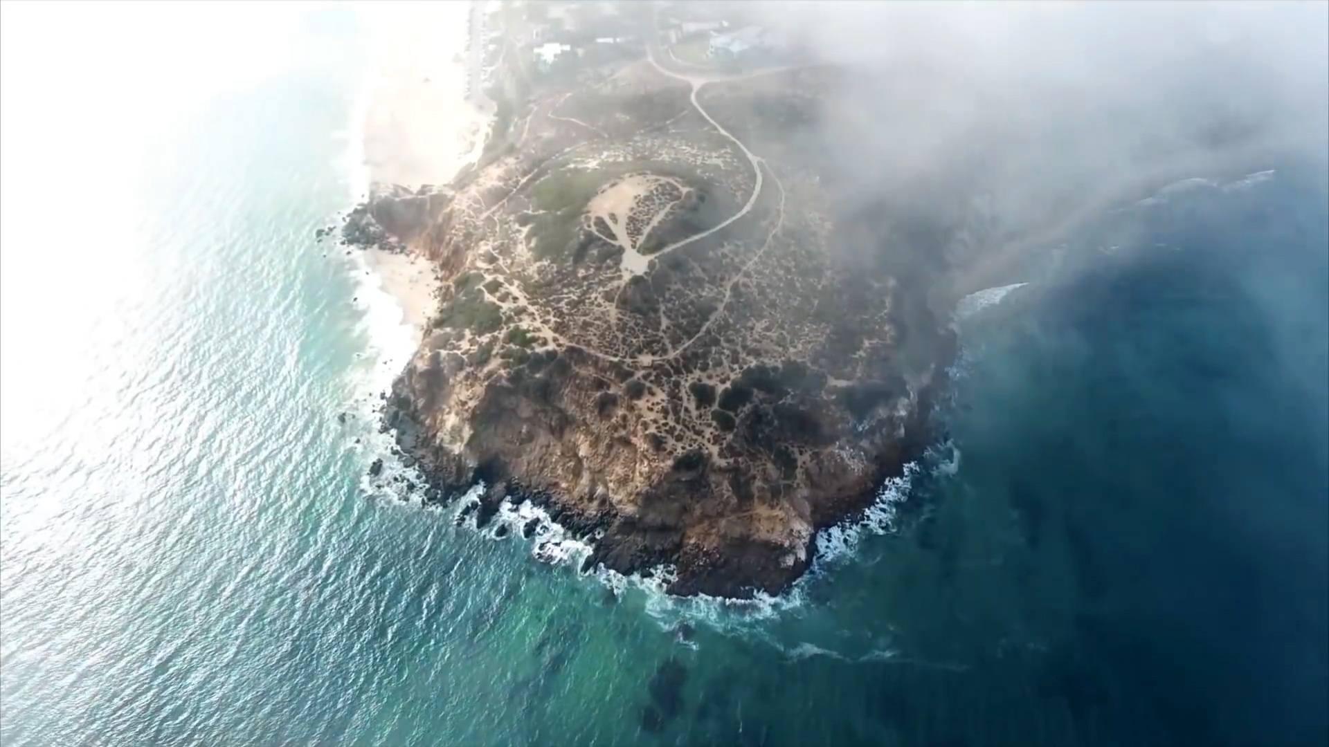
From Malibu Colony to the Pacific Coast Highway and the cliffs above Point Dume, our drones capture Malibu’s luxury estates, coastal terrain, and development sites with clarity and accuracy. Whether documenting new hillside builds, mapping oceanfront parcels, or showcasing architectural design, AeroViews ensures every detail is delivered safely, legally, and beautifully from the sky.
High-Resolution Aerial Imaging, Topographic Mapping & LiDAR Data Collection in Malibu, CA
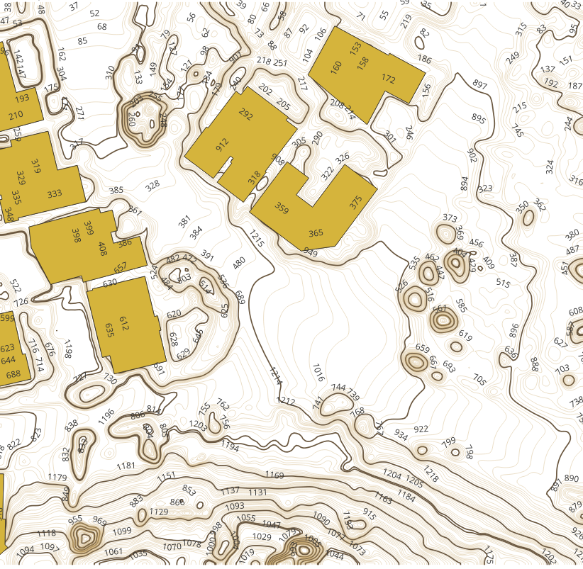
Malibu’s complex topography — steep coastal slopes, canyons, and oceanfront construction zones — requires drone mapping and LiDAR solutions designed for accuracy and efficiency. AeroViews produces topographic maps, 3D surface models, and LiDAR scans that support architects, civil engineers, and environmental consultants.
From grading assessments near Broad Beach Road to terrain mapping above Latigo Canyon, we deliver geo-referenced data and orthomosaics that integrate directly into AutoCAD, Civil 3D, and GIS systems. Every project includes detailed flight planning, precision control points, and rapid data turnaround.
Ready to elevate your project with professional drone services?
Contact AeroViews today for a free quote and let’s plan your next flight in Malibu.
A local Malibu commercial drone services company
a few of our services
- Commercial Real Estate Drone Photography
- Commercial Real Estate Drone Videography
- Construction Site Drone Photography & Video
- Drone 3D Mapping (Orthomosaic & DSM)
- LiDAR Drone Mapping & Data Collection
- Drone Surveying Services (Photogrammetry + Topographic Mapping)
- Solar Installation Drone Photography / Video

Whatever your project, we bring it to life from above with precision aerial imaging.
From coastal real estate cinematics to hillside terrain mapping, AeroViews provides high-resolution visuals and LiDAR data designed for Malibu’s challenging landscapes. Our team captures the natural beauty and topographic complexity of the area — transforming raw aerial data into accurate, actionable imagery.
Whether supporting hillside construction, documenting erosion control, or creating marketing content for oceanfront estates, our Malibu team delivers reliable, FAA-compliant results. We help clients plan, measure, and market their projects with precision aerial data and cinematic quality that meet Malibu’s elevated standards.