Table Of Contents
Control points in surveying are precisely measured reference locations used to anchor all other measurements to real-world geographic coordinates. These are physical spots — often marked on the ground or a permanent structure — whose latitude, longitude, and elevation are known with high accuracy.
In simple terms, a control point is like the “You Are Here” dot on a map at a mall or park — it gives you a fixed, known location that everything else is measured from.
Surveyors use control points to ensure that maps, boundaries, and elevation models are aligned correctly with the real world. If a control point is off, even slightly, then everything tied to it can be misaligned — which could lead to bad data, misplaced infrastructure, or costly errors in construction and design.
Getting control points right is critical in all types of surveying, from traditional land development to drone-based photogrammetry, as outlined in Esri’s guide to control networks and field-tested by teams like AeroViews.

Understanding Control Points in Surveying (Definition & Importance)
Control points serve as the foundation of accurate surveying and mapping. These are known reference locations that surveyors use to ensure every measurement is aligned to a true position on Earth — whether it’s for a small property boundary or a large infrastructure project.
Without them, the map could shift, stretch, or rotate — and none of your measurements would line up with reality.
Here’s what makes control points so essential:
Precisely Known Position
Every control point has surveyed coordinates in a defined coordinate system — typically expressed as X, Y, Z or latitude, longitude, and elevation. These points are often marked by metal disks, stakes, nails, or rebar, depending on whether they’re permanent or temporary.
Reference for All Measurements
Control points serve as the starting point for every other measurement on a site. Whether you’re mapping a road, laying out a foundation, or flying a drone mission, everything ties back to control to ensure spatial consistency.
Prevents Accuracy Loss Over Distance
Without control points, errors in measurement can snowball as you move farther from your starting location. Control points help maintain accuracy across long distances and large sites by “resetting” your position.
Horizontal and Vertical Control
Some control points are used for horizontal position (like easting/northing), others for vertical control (elevation), and some provide both. Combined, they create a 3D reference grid that surveyors and mapping software can build on. As Atlas Geospatial notes, this dual control system is what gives drone maps their vertical precision.
Temporary vs. Permanent Points
Control points can be long-term benchmarks established by agencies (e.g., NGS monuments), or temporary points set for a specific project. On construction sites or during drone GCP placement, we often use temporary controls like hub nails, painted Xs, or mini targets that stay consistent throughout the job.
Why It Matters
If your control points are off, everything built on top of them will be off too. For example, if you’re mapping a new commercial site and the control is shifted by even a foot, your entire site plan will be misaligned — leading to costly rework or boundary disputes.
This is why, in both traditional ground surveys and drone mapping, control points are non-negotiable. They’re the accuracy framework that makes precision possible.
Control Points vs. Checkpoints
| Feature | Control Point | Checkpoint |
|---|---|---|
| Purpose | Anchors the survey to known geographic coordinates | Validates the accuracy of the survey or model |
| Used For | Alignment and scale of measurements (X, Y, Z) | Quality control and accuracy verification |
| Included in Processing? | Yes – used to geo-reference drone data or survey models | No – withheld from processing to serve as independent check |
| Physical Marking | Yes – targets, nails, rebar, painted Xs | Yes – similar to control points |
| Data Collected | Coordinates and elevation (GNSS or total station) | Same, but not used in alignment |
| Common in | Drone mapping, construction layout, boundary surveys | Photogrammetry QA, LiDAR accuracy validation |
Control Points vs. Ground Control Points (GCPs)
It’s easy to confuse control points and ground control points — especially in drone mapping workflows. While they’re closely related, they serve slightly different purposes depending on whether you’re working from the ground or the air.
Control Points (General Surveying)
Control points are a broad category of reference locations with known geographic coordinates. These can be:
- A metal benchmark in the ground
- A painted nail in pavement
- A stake or rebar hub placed during construction
They’re used in everything from boundary surveys to site layout and construction staking, and serve as fixed anchors to start measurements or check positioning. Some control points may be visible, others may be buried or subtle — their main function is accuracy, not visibility.
Atlas Geospatial outlines how these points form the spatial backbone of traditional survey work.

Ground Control Points (Drone Mapping & Photogrammetry)
Ground control points (GCPs) are a specific type of control point used for aerial surveying. What makes them different?
- GCPs are placed intentionally on the ground so they’ll show up clearly in drone imagery.
- They have known GNSS coordinates (measured with RTK/PPK gear like the Emlid RS3).
- Their purpose is to help photogrammetry software align and scale the aerial data to real-world coordinates.
Think of a GCP like a giant bullseye on the ground — it’s there to tell the drone software, “This exact spot in the photo is here in real life.”
DroneDeploy’s guide explains how GCPs improve the accuracy of 2D and 3D models during image processing, especially in mapping environments without strong RTK correction.
So What’s the Difference?
| Control Points | Ground Control Points (GCPs) | |
|---|---|---|
| Used In | Land surveying, construction, boundaries | Drone mapping, photogrammetry |
| Must Be Visible? | Not always – may be buried or subtle | Yes – must be photo-visible in aerial images |
| Main Function | Reference for measurements and layout | Aligns and scales drone imagery to real-world coordinates |
| Data Needed | Coordinates (X, Y, Z) | Coordinates + photo identifiability |
| Captured With | GNSS receiver, total station | GNSS + aerial imagery |
A ground control point (GCP) is a type of control point designed specifically for drone and aerial mapping. All GCPs are control points, but not all control points are GCPs. The key difference is visibility — GCPs must show up in aerial photos to help software accurately position and scale the resulting maps.
What Are Ground Control Points (GCPs)?
Ground Control Points (GCPs) are marked locations on the ground with known, survey-grade coordinates, used to geo-reference drone imagery and aerial maps. They serve as real-world anchors for photogrammetry software to accurately scale and position 2D or 3D models.
In plain language, a GCP is like a bullseye target you lay down before a drone flight. Since you already know its exact location on Earth, you can use that point to tell your drone map, “This spot goes here.”
As explained by the USGS and Civil Tracker, GCPs are critical for high-accuracy aerial surveys — especially when RTK or PPK corrections are not available or you need to validate a dataset.
How GCPs Work in Drone Photogrammetry
When flying a drone survey, the drone captures hundreds of overlapping photos. These images are later stitched together by photogrammetry software to create a large orthomosaic map or 3D model.
But here’s the catch: a drone’s built-in GPS may only place those photos within a few meters of their true location. That’s not good enough for survey-grade deliverables.
By identifying GCPs in the photos — and assigning them their real-world coordinates — the software can:
- Shift the map to match actual ground positions
- Scale the model correctly
- Reduce overall error across the dataset
This step drastically improves absolute accuracy, ensuring your drone map matches the true coordinate system on the ground. We follow this exact process at AeroViews when validating LiDAR flights or producing engineering-grade site maps.
Characteristics of a GCP
| Attribute | Description |
|---|---|
| Highly Visible in Aerial Images | GCPs are painted Xs, crosses, or checkerboard patterns in high-contrast colors (black/white, fluorescent) so they’re easy to identify from above. |
| Strategically Spread Out | GCPs are distributed across the site — corners and center — to control scale, tilt, and position. |
| Survey-Grade Coordinates | Each GCP is recorded with precise GNSS or total station measurements (X, Y, Z). |
| Temporary or Semi-Permanent | GCPs can be washable paint, foldable targets, or semi-permanent markers if repeat surveys are planned. |
In Photogrammetry, GCP = Control Point
When someone asks, “What is a control point in photogrammetry?”, the answer is: it’s a GCP — a known, visible ground reference used to align and scale the model.
Without GCPs, you might get a map with good relative shape (e.g. the building looks like a building), but it won’t be accurately placed in the real world — a problem for any engineering, planning, or legal use.
How Ground Control Points (GCPs) Work in Drone Mapping
GCPs are placed on the ground and measured with high-precision GPS. During post-processing, software uses those points to align and scale the drone-captured imagery into an accurate map or model.
Why Are Ground Control Points Used?
Ground control points (GCPs) are used for one essential reason: to make drone maps and models accurate in the real world.
Here’s how they deliver that precision:
1. Improve Map Accuracy
Without GCPs, a drone map might look good — but be off by several feet. That’s fine for basic visuals, but not for engineering or legal use.
With well-placed GCPs, the same map can be accurate to within 1–2 inches, making it suitable for grading, site layout, and boundary verification.
AeroViews uses GCPs to validate LiDAR flights and contour maps, especially on jobs where RTK links may drop or GNSS conditions vary.
2. Ensure Correct Scale and Position
GCPs act like anchor bolts for your map — they lock it into place so that scale and alignment match reality. Roads, buildings, and property lines appear where they actually are.
This prevents “drift” or distortion in orthomosaics and 3D models.
3. Tie into Coordinate Systems
Surveyors often need to deliver data in local or national coordinate systems — like UTM or state plane.
GCPs allow drone imagery to be geo-referenced into those systems, so your data lines up with existing plats, site plans, or GIS layers.
4. Ensure Consistency Over Time
When flying the same site repeatedly (e.g. monthly progress flights), using the same GCPs gives you apples-to-apples comparisons.
This is critical for:
- Cut/fill volume tracking
- Construction QA
- Monitoring erosion or grading changes
The GCPs keep every dataset tied to a common ground truth.
5. Correct GPS & Camera Errors
Even with a good drone, onboard GPS can be off by several meters, and camera distortion can warp imagery.
According to Civil Tracker, consumer drones often have up to 5 meters of horizontal error and 20 meters of vertical error without GCPs. With GCPs? That drops to just a few centimeters.
6. Enable Survey-Grade Outputs
With GCPs, your drone deliverables (e.g. topographic contours, point clouds, stockpile volumes) become accurate enough for engineering and construction. You get legal-quality data from a drone — when it’s properly grounded.
In Plain Terms…
A GCP turns your drone map from a pretty picture into a professional-grade survey. It’s the difference between an art print and a blueprint.
Whether you’re mapping a 200-acre development or validating fill volumes on a grading site, GCPs add the trust and precision needed to use drone data with confidence.
This is an excellent, highly practical section that will rank well for questions like:
- How many GCPs do I need?
- Ground control points per acre
- How to place GCPs for drone mapping
Let’s format it with:
- Clear subheadings
- A snippet-optimized “Bottom Line” takeaway
- Embedded references
- Professional tone with just enough plain-language explanation to connect with non-surveyors
How Many Ground Control Points Do You Need (Per Acre)?
One of the most common questions we get in the field is:
“How many ground control points should I use for a drone survey?”
There’s no perfect formula, but here are field-tested guidelines that AeroViews and other professionals follow to get consistent, survey-grade results.
Minimum GCPs for Any Site
Even for a small site, you’ll want at least 4–5 GCPs. These are typically placed:
- At each corner of the mapping area (4 total)
- Plus 1 near the center to stabilize accuracy
This “frame + center” layout provides a solid geometric reference for your map, and is backed by both ECI 3D and JOUAV best practices.
GCPs for Larger Areas
As your site grows, you don’t need a strict “GCPs per acre” formula — but coverage still matters.
For example:
- A 50-acre survey typically uses around 8 GCPs
- That’s roughly 1 GCP per 6–7 acres for balanced control
You’re not just scaling by size — you’re maintaining control coverage across the site to prevent drift or distortion in any direction.
For Sites Over 50 Acres
For larger projects (e.g. 80–100 acres or more), add 1–2 GCPs per additional 10–20 acres. A well-distributed layout might include:
- Corners
- Midpoints of edges
- A few in the interior
So a 100-acre site could have 12–15 GCPs, depending on terrain and accuracy goals.
Distribution > Density
Where you place your GCPs matters more than how many.
Bad: 6 GCPs clustered in one corner
Good: 6 GCPs spaced evenly across the entire project, including interior points
Even, well-distributed coverage helps the photogrammetry software accurately model the full surface — especially at the edges.
Terrain and Accuracy Requirements
- Hilly or complex terrain? Use extra GCPs to account for elevation changes.
- Flat, uniform sites? You might get away with fewer.
- Ultra-high precision needs? Add GCPs near critical features or grade breaks.
JOUAV recommends increasing GCP count for rugged areas or highly technical deliverables.
If You’re Using RTK or PPK Drones
With RTK/PPK-equipped drones (like the Matrice 350 RTK or WingtraOne Gen II), you may reduce the number of GCPs needed.
Some teams fly:
- Just 4–5 GCPs total
- And use them more as checkpoints than control points
That said, many professionals still place at least a few GCPs as a quality check — especially for vertical accuracy or when RTK correction may drop out during flight.
Bottom Line
For most drone surveys without RTK, plan for 5–10 GCPs.
Always place at least four at the outer edges, and add more as the site grows or gets complex.
It’s better to have a few extra than not enough. Too few GCPs can lead to warped or misaligned maps — especially near the edges of the survey.
GCP Layout Examples: Small vs. Large Site
Small sites typically use 4 GCPs around the corners and 1 in the center. Larger surveys require more GCPs, spaced throughout to ensure even control coverage and maintain accuracy across the entire model.
How to Get or Create Ground Control Points
Once you know GCPs are essential for mapping accuracy, the next question is:
How do you actually create or get them?
There are two parts to every GCP:
- A physical target that’s visible in drone imagery
- A known coordinate (lat/lon/elevation) assigned to that exact spot
Here’s how to set them up properly — whether you’re using DIY methods or professional gear.
1. Check for Existing Control Points First
Before creating new targets, see if there are any existing survey markers on or near your site:
- Government benchmarks
- Property pins or monuments
- Previous site control from past projects
If they’re visible from the air (or can be marked so they are), they can serve as excellent GCPs — with the benefit of already-known coordinates.
2. Create Physical GCP Targets
If there’s no usable control, you’ll need to create your own visible targets.
Guidelines for GCP Placement:
- Choose flat, open locations with good sky visibility for GNSS signals
- Place targets near corners, midpoints, and the interior of the site
- Avoid locations near buildings, vehicles, or moving shadows
GCP Target Options:
- Spray-painted Xs (biodegradable paint works well)
- Checkerboard panels or vinyl targets
- Rubber mats, floor tiles, or cut plywood with high-contrast designs
According to Civil Tracker, the best targets are 30–60 cm across, with bold black/white or neon colors for visibility.
Make sure the exact center of the target is clear — the intersection of an X or the center of a checkerboard is what you’ll survey.
Secure the targets with nails, stakes, or weights so they don’t move before the flight.
3. Measure the Coordinates
This is the most important step: you need accurate GPS coordinates for each target. Here’s how:
- Use a survey-grade GNSS receiver, ideally with RTK or PPK capability
- Or a total station if you’re working from a known benchmark
- Measure in the correct coordinate system (e.g. WGS84, State Plane, UTM)
- Double-check your data — even reoccupy the point if needed
Your map is only as accurate as your GCP measurements. Make sure your rover is calibrated, and log each point clearly.
AeroViews recommends capturing in local coordinate systems when delivering to civil or engineering teams.
4. Import GCPs into Your Mapping Software
Once your targets are marked and measured:
- Import the coordinates into your drone mapping platform (e.g. Pix4D, DroneDeploy)
- Tag the GCPs on the aerial images
- Let the software adjust the map during the georeferencing step
This is where GCPs correct distortion and align the drone model to the real world.
5. Optional: Use Commercial GCP Solutions
If you map frequently or want to simplify setup, there are commercial options:
- Pre-printed GCP targets (vinyl mats, reusable panels)
- Smart GCPs like Propeller AeroPoints, which include a built-in GPS unit
These can save time but come at a cost. For many surveyors, DIY targets + a good GNSS rover still give the best value — as confirmed by the Pix4D user community.
In Summary
A ground control point is simply a visible, fixed marker on the ground with known coordinates.
To create one:
- Mark a visible, secure target
- Measure its position accurately with survey tools
- Import and tag it during map processing
If you’re new to surveying or don’t have the right tools, this is a step where it’s smart to call in a professional surveyor or drone survey team like AeroViews.
Precision here makes all the difference in your final results.
How AeroViews Captures and Uses GCPs in Drone Surveys
As a professional drone surveying company serving Los Angeles, San Diego, Orange County, Riverside County, San Francisco, and San Jose, AeroViews uses a refined workflow to deploy ground control points (GCPs) for survey-grade accuracy — whether we’re working with developers, civil engineers, or landowners.
Here’s how we do it:
1. Project Planning
Before we fly, we assess:
- Site layout and size
- Required accuracy
- Coordinate systems
We determine how many GCPs are needed, and where to place them for maximum control. A small residential lot might get 4–5 GCPs, while a 100-acre topographic site might use 12–15. If existing survey markers are present, we’ll integrate those to align with official datums or property lines.
2. Placing the GCPs
On survey day, our crew places durable, high-contrast targets — typically 2′ x 2′ checkerboards or crosses designed to be visible from altitude.
We place them:
- Around the site perimeter
- In the interior zones for balanced distribution
- Away from obstructions (trees, buildings) for optimal GPS signal
We ensure that each target’s center is clearly marked and stable, using stakes or weights when necessary.
3. Surveying the GCPs
Using survey-grade GNSS receivers — often with RTK corrections — we record the position of each GCP with centimeter-level accuracy.
Our team:
- Cross-checks readings
- Performs site localization if needed (to match project coordinate systems)
- Converts to client-specified datums or projections when required
This step ensures our maps align precisely with construction plans, CAD drawings, and GIS data.
4. Drone Flight & Data Collection
With control points in place, we conduct the drone survey — capturing high-overlap aerial photos or LiDAR data.
Our pilots:
- Fly pre-planned routes with consistent overlap
- Visually confirm GCPs are captured in the imagery
- Record shot IDs for fast GCP tagging during processing
5. Data Processing & Georeferencing
Back at our workstation:
- We import the drone imagery and GCP coordinates into Pix4D, DroneDeploy, or custom photogrammetry software
- Tag each GCP manually in multiple images
- Let the software georeference and align the map using those known points
At AeroViews, this process consistently yields horizontal and vertical accuracy within 1–2 inches, depending on terrain and layout.
6. Quality Assurance with Checkpoints
For high-accuracy jobs (e.g. earthwork validation or legal boundary overlays), we set a few extra GCPs as checkpoints:
- Not used in processing
- Measured independently
- Used to verify the map’s real-world accuracy
We include a report on error metrics, showing how well the processed model matched the field-surveyed data — a major value add for engineers and construction teams.
7. Deliverables You Can Trust
With the GCPs integrated:
- Our orthomosaic maps and 3D models are ready for direct use in CAD, GIS, or design workflows
- Property lines, contours, and features land exactly where they should
- Clients get data they can trust — whether it’s a contour map for permitting in Orange County or a volumetric stockpile report in San Jose
Why It Matters
GCPs bridge the gap between drone efficiency and survey-grade accuracy.
Whether you’re a developer who just wants to know the data is aligned, or a civil engineer matching coordinates to a project benchmark, AeroViews delivers field-tested results you can count on — every time.
FAQ: Common Questions about Control Points and GCPs
Why are primary control points essential in survey networks?
Primary control points are essential in survey networks because they establish a fundamental framework for accurately determining location and alignment in various surveying tasks. These points provide crucial reference coordinates used in topographic surveys, construction projects, and other analyses. By serving as reliable anchors for the control network, primary control points enhance the precision of measurements and the integrity of topographic maps.
How do state plane coordinates differ from other surveys in terms of use?
State plane coordinates differ from other surveys because they are designed to provide a high degree of accuracy for localized regions. These coordinates minimize distortion over small areas and are commonly used in construction projects and public domain works where precision in horizontal coordinates is pivotal. Unlike broader geographic systems, state plane coordinates offer a practical reference for a wide range of local surveying and mapping applications.
What is the role of topographic surveys in construction projects?
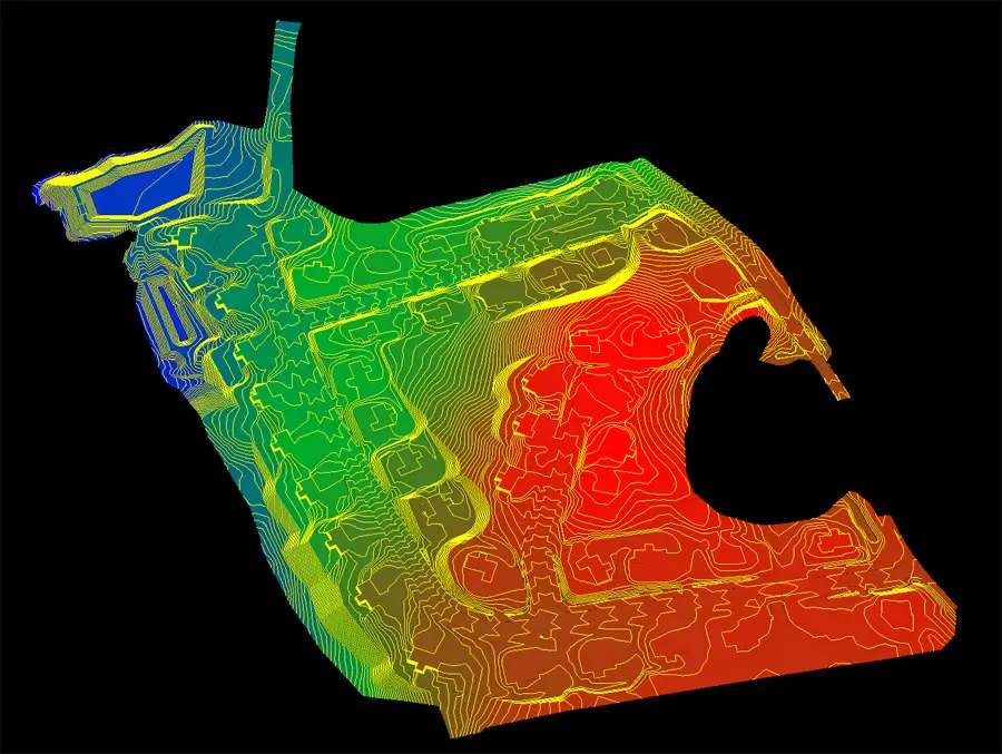
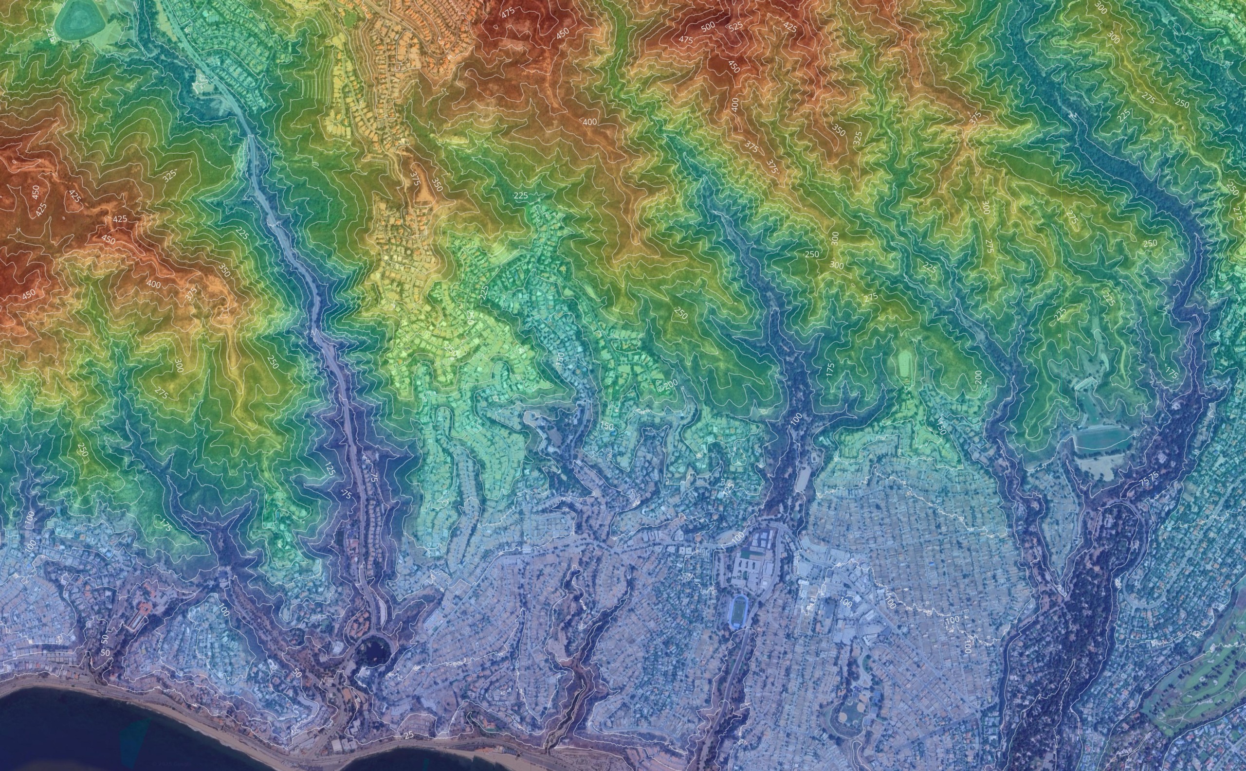
Topographic surveys play a vital role in construction projects by providing detailed maps and analysis of the terrain. These surveys capture the contour lines, elevation, and various features of the land, serving as the basis for planning and development. By using topographic surveys, construction teams can make informed decisions regarding site preparation, design, and layout, ensuring that projects are executed with a high degree of accuracy and efficiency.
Why is a high degree of accuracy important in control coordinate systems?
A high degree of accuracy in control coordinate systems is crucial for ensuring that all related measurements and analyses are reliable and precise. These systems form the backbone of various surveying tasks, where even minor errors in point placements can lead to significant discrepancies in the outcomes. Accurate control coordinates facilitate the integration of different types of data, support thorough analysis, and ensure the integrity of engineering, architectural, and geographical projects.
What is the purpose of a control survey in mapping and construction?
A control survey serves the critical purpose of establishing a framework of reference points used throughout mapping and construction projects. These surveys provide precise data regarding the position of reference points and other points, ensuring that all subsequent measurements are accurately aligned with this foundational structure. In construction, control surveys ensure that all elements of a project are executed according to the planned design, maintaining consistency and precision across various applications.
How do reference points contribute to the accuracy of control surveys?
Reference points contribute significantly to the accuracy of control surveys by providing fixed positions that act as benchmarks for all related measurements. Establishing accurate reference points is crucial, as they guide the placement and verification of other points within the survey. The consistency and reliability of these initial points ensure that the resultant data and mapping from control surveys are precise, enabling correct alignment and integration in construction, engineering, and geographical assessments.
What roles do other points play in ensuring the accuracy of a control survey?
Other points play supporting roles in ensuring the accuracy of a control survey by acting as subsidiary markers that extend the reach and detail of the survey framework. These points help in verifying the accuracy of the primary reference points and enhance the network’s overall precision. By providing additional data that complements the reference points, they ensure comprehensive coverage and fidelity in mapping and construction applications.