Table Of Contents
Why Ground Control Points Still Matter in Modern Drone Surveying
Drones have revolutionized land surveying, offering faster data collection, real-time insights, and scalable workflows. But even as RTK (Real-Time Kinematic) and PPK (Post-Processed Kinematic) technologies become more common, one tool remains indispensable for precision mapping: the Ground Control Point, or GCP.
What is a Ground Control Point?
A Ground Control Point is a physically marked location on the ground with precisely measured coordinates. These points are used in drone surveying to align aerial images with geographic coordinates, improving both positional accuracy and the reliability of mapping results.
Whether you’re capturing orthomosaics, creating elevation models, or generating 3D site reconstructions, GCPs serve as geospatial anchors. They bridge the gap between what your drone sees from above and the real-world terrain on the ground.
In this guide, we’ll cover:
- What Ground Control Points are and how they work
- How GCPs enhance drone surveying and photogrammetry workflows
- Best practices for placement, data capture, and accuracy validation
- When to use GCPs vs. relying on RTK/PPK positioning systems
Understanding how to use Ground Control Points effectively ensures your surveys are not just fast—but also accurate, repeatable, and professional-grade.
Accuracy Comparison: With and Without Ground Control Points
| Method | Horizontal Accuracy | Vertical Accuracy | Typical Use Case |
|---|---|---|---|
| No GCPs (GPS Only) | ±30–50 cm | ±40–80 cm | Rough visual maps, basic inspection |
| RTK/PPK Only (No GCPs) | ±3–10 cm | ±5–15 cm | Construction layouts, earthwork |
| GCPs + RTK/PPK Combined | ±1–3 cm | ±2–5 cm | Survey-grade topographic mapping |
What Are Ground Control Points (GCPs)?
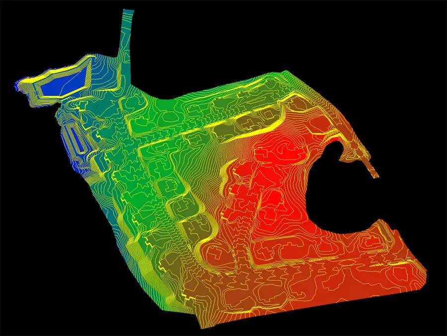
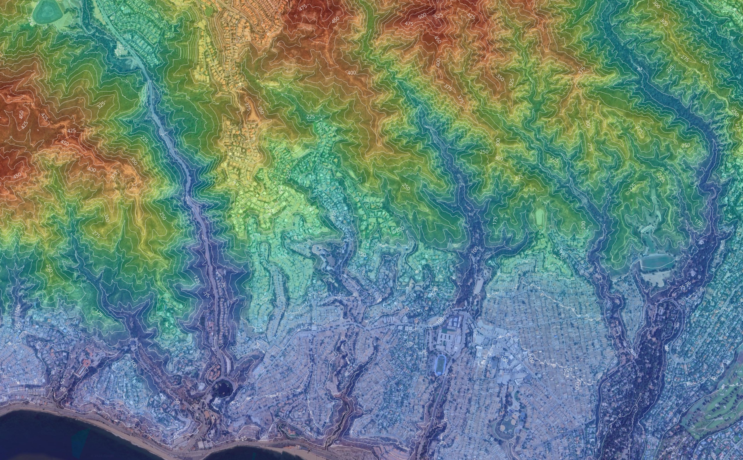
Ground Control Points (GCPs) are physical markers placed on the surface of the earth that have precisely known coordinates. These reference points are used to align drone images, satellite imagery, and other remote sensing data to real-world locations. Their main role is to enhance the absolute accuracy of aerial surveys and ensure that what is displayed in your drone map or aerial photogrammetry output truly matches the earth’s surface.
In drone surveying, GCPs act as ground truth anchors. They are used during image processing to match tie points in overlapping drone imagery or image chips, correcting for scale, tilt, and terrain distortion. This allows surveyors to create accurate representations of the environment, even in complex terrain.
For example: When a drone flies over a construction site, the onboard GPS may record image positions with ±5 meters of error. But when GCPs are used to calibrate those drone flights, the final output can achieve absolute and overall accuracy down to 2–3 cm.
Why GCPs Are Still Critical for Accurate Results
Even with advancements in RTK/PPK drones, GCPs remain vital when:
- Working in areas with low absolute accuracy signals (e.g., urban canyons or forests)
- Validating results against real world coordinates
- Performing analysis on project areas that require legal or engineering-grade precision
- Producing maps or 3D models for users who demand accurate results and reliable deliverables
GCPs ensure your data is not only sharp but also true to location. They help survey teams identify control targets, place GCPs effectively, and achieve alignment between imagery and the defined project site.

How to Use Ground Control Points Effectively
Getting the most out of Ground Control Points (GCPs) requires more than just placing a few markers on the ground. To truly improve accuracy and generate quality results, you need a structured workflow that focuses on precise gcp placement, measurements, and proper integration with photogrammetry software.
Planning GCP Placement: Key Considerations
Strategic placement of GCPs is crucial to ensuring data aligns with its true location. The markers should be evenly distributed across the project area, covering both the center and outer edges of the flight zone. It is recommended to use at least five ground control points for a flight area to achieve high accuracy in aerial mapping.
Best practice: Use a minimum of 5 GCPs—one near each corner and one in the center.
Each GCP must be clearly visible in multiple drone images to serve as a reliable reference line. Avoid placing markers in shaded areas or near obstructions that may affect visibility in the aerial imagery. Ground control points should be placed in flat areas to avoid inaccurate elevation measurements due to slope.
Recording Accurate Measurements
Once your GCPs are placed, use high-precision GPS or RTK receivers to collect their real-world coordinates. These measurements are the backbone of your map’s geospatial alignment. Any inaccuracy here can lead to compounding errors during the image stitching process.
Note: For survey-grade work, aim for sub-3 cm horizontal and vertical accuracy during data collection.
This step is typically carried out in coordination with ground teams before or immediately after drone flights to ensure the most accurate data pairing.
Integrating GCPs into the Photogrammetry Workflow
After flying the drone mission, the collected imagery and GCP coordinate data are imported into photogrammetry software such as Pix4D, Agisoft Metashape, or DroneDeploy. The software uses GCPs as anchor points to recalibrate and correct the image block, enhancing the final output’s quality and spatial fidelity.
Including a table of GCPs with their respective X, Y, and Z values is standard practice when submitting survey documentation or deliverables to clients.
Maximizing GCP Capabilities Across Projects
While RTK/PPK systems are improving, GCPs remain key for high-stakes use cases such as:
- Construction site modeling
- Infrastructure inspection
- Earthwork volume calculations
- Progress monitoring
Their integration supports traceable, repeatable outcomes—which is crucial for engineering, legal, and compliance-based workflows.
GCP Accuracy: How Much Do They Improve Survey Precision?
Understanding the Accuracy Impact of GCPs in Aerial Photogrammetry
In aerial photogrammetry, accuracy depends heavily on the alignment between captured drone imagery and known positions on the ground. That’s where Ground Control Points come in. When you place GCPs correctly across a site, they act as known geospatial anchors that dramatically enhance the alignment and scale of your data outputs.
These points are essential for correcting distortions introduced during flight, such as changes in terrain elevation, lens distortion, or image overlap inconsistencies.
How GCPs Strengthen Tie Points for Image Alignment
During processing, photogrammetry software identifies natural features or shared pixels across overlapping images—these are known as tie points. While tie points help create a relative 3D model, they don’t guarantee geospatial accuracy.
GCPs bridge this gap by aligning those tie points to true ground coordinates, allowing the software to calibrate and correct spatial inconsistencies in the dataset. The result is a more reliable, survey-grade output that reflects the actual geometry of the site. The accuracy of datasets without GCPs is typically 10-200 meters off for non-orthorectified satellite images and single meters for aerial imagery.
Accuracy Improvement: With vs. Without GCPs
Here’s a quick look at how much accuracy can shift depending on the use of GCPs in your survey workflow:
| Method | Horizontal Accuracy | Vertical Accuracy | Use Case |
|---|---|---|---|
| No GCPs (GNSS only) | ±30–50 cm | ±40–80 cm | Rough visualization |
| RTK/PPK only | ±3–10 cm | ±5–15 cm | Mid-grade inspections |
| RTK/PPK + GCPs Combined | ±1–3 cm | ±2–5 cm | High-precision engineering surveys |
In many cases, only the combination of precise GPS logging and properly placed GCPs ensures the project meets engineering or legal requirements.
This level of control and confidence is why GCPs remain an essential part of any aerial photogrammetry workflow where drone imagery must meet professional standards.
GCPs vs. RTK/PPK: Do You Still Need to Place GCPs?
As high-end drones with RTK (Real-Time Kinematic) and PPK (Post-Processed Kinematic) capabilities become more accessible, many professionals ask: “Do I still need to place GCPs if my drone is already collecting precise data?” The short answer: it depends on your project requirements and your desired level of accuracy.
The Limits of RTK/PPK Without GCPs in Drone Imagery
RTK and PPK improve positional accuracy by correcting GPS signals during or after flight. However, they’re not infallible. Environmental factors like signal multipath errors, GNSS satellite geometry, or poor correction data can all affect accuracy—especially in areas with tree cover, buildings, or rolling terrain.
In these cases, even high-precision RTK solutions can introduce errors in your drone imagery. Without GCPs, the software relies solely on relative accuracy, which may not meet the standards required for legal, engineering, or volume analysis deliverables.
When You Should Still Place GCPs
You should always place GCPs when:
- Surveying for engineering-grade accuracy (±3 cm or better)
- Creating deliverables with legal implications, like boundary disputes or certified topographic maps
- Operating in environments with poor RTK coverage or GNSS obstruction
- You need to validate the accuracy of an RTK/PPK-enabled system
GCPs act as a fail-safe that ensures drone imagery is correctly aligned with ground truth data—even if something goes wrong in-flight.
When You Can Consider Skipping GCPs
In contrast, you might safely skip GCPs if:
- Your project is for general visualization or site monitoring only
- You’re working in an open, obstruction-free area with strong GNSS correction signals
- Your client or jurisdiction doesn’t require certified accuracy levels
- You’ve previously validated your drone system in similar environments
Even in these cases, using at least 1–2 checkpoints (non-processing control points) is still recommended to verify alignment and output reliability.
Common Mistakes When Using GCPs (And How to Avoid Them)
Even with the best intentions, errors in the Ground Control Point (GCP) workflow can compromise the entire accuracy of a survey. Whether you’re working on a construction site, a corridor mapping project, or high-resolution aerial photogrammetry, avoiding these common mistakes is essential to ensure quality results. Permanent ground control points save time and costs for projects that require repeated drone flights.
Mistake 1: Placing GCPs Without Strategic Coverage
A frequent mistake is failing to place GCPs across the full extent of the flight area. Too often, GCPs are clustered in one region—usually the center—leaving edges and corners underrepresented. This imbalance reduces alignment accuracy, especially at the periphery of the model.
Best Practice: Distribute GCPs evenly, including all four corners and at least one near the center. For large or irregularly shaped sites, more may be required.
Mistake 2: Inaccurate or Incomplete Measurements
Using low-accuracy equipment to record GCP positions or skipping vertical elevation data will lead to spatial drift in your model. Every centimeter of error in GCP coordinates propagates across your entire dataset.
Best Practice: Use RTK/PPK or total stations for coordinate capture, and always log both horizontal and vertical measurements.
Mistake 3: Poor Visibility in Drone Imagery
GCPs that are obscured by shadows, vegetation, or low-contrast surfaces are often missed in drone imagery, reducing their usefulness during processing.
Best Practice: Use high-contrast markers (e.g., checkerboard or cross-pattern) and avoid placing them near tall vegetation or reflective surfaces. Check your flight plan to ensure optimal camera angles.
Mistake 4: Misalignment During Photogrammetry Processing
Incorrectly tagging GCPs or failing to cross-reference the right image files during software setup is a technical oversight that often goes unnoticed—until the final map doesn’t align with the real world.
Best Practice: Use identifiable tie points in your GCP imagery and validate them in multiple overlapping photos. Always verify image-GCP associations before processing the final model.
Mistake 5: Using Too Few GCPs or None at All
Omitting GCPs altogether or using only one or two across large project areas introduces serious risk, particularly if RTK corrections drop or GPS drift occurs mid-flight.
Best Practice: Always err on the side of over-placing rather than under-placing. Even in RTK-equipped missions, 4–5 GCPs can serve as a validation layer and backup reference.
Avoiding these mistakes not only strengthens your data integrity but also protects your professional reputation by delivering consistently accurate, reliable, and repeatable results.
Why Ground Control Points Remain a Gold Standard in Surveying
Despite the rise of RTK/PPK drone systems and AI-powered photogrammetry software, Ground Control Points (GCPs) remain an irreplaceable asset in high-precision surveying. Their ability to anchor drone imagery to real-world coordinates ensures not just relative accuracy—but true geospatial reliability.
Whether you’re producing elevation models, tracking construction site progress, or verifying infrastructure layouts, GCPs offer the control and validation that technology alone can’t guarantee. They’re especially vital when your project demands:
- Regulatory compliance
- Engineering-grade deliverables
- Repeatable and audit-ready documentation
Knowing how to place GCPs properly, measure them accurately, and integrate them into your aerial photogrammetry workflow is key to elevating your survey results from good to exceptional.
As drone surveying continues to scale across industries—from agriculture to energy to urban planning—those who master the fundamentals, including Ground Control Points, will stand out in both technical capability and data quality.
If your goal is to produce maps and models that clients can trust, then GCPs aren’t optional—they’re essential.