Long Beach Drone Photography, Mapping & LiDAR Services
AeroViews delivers advanced drone photography, mapping, and LiDAR imaging across Long Beach, CA. Our FAA-certified pilots provide precise aerial visuals and geospatial data for construction, engineering, and coastal development projects.
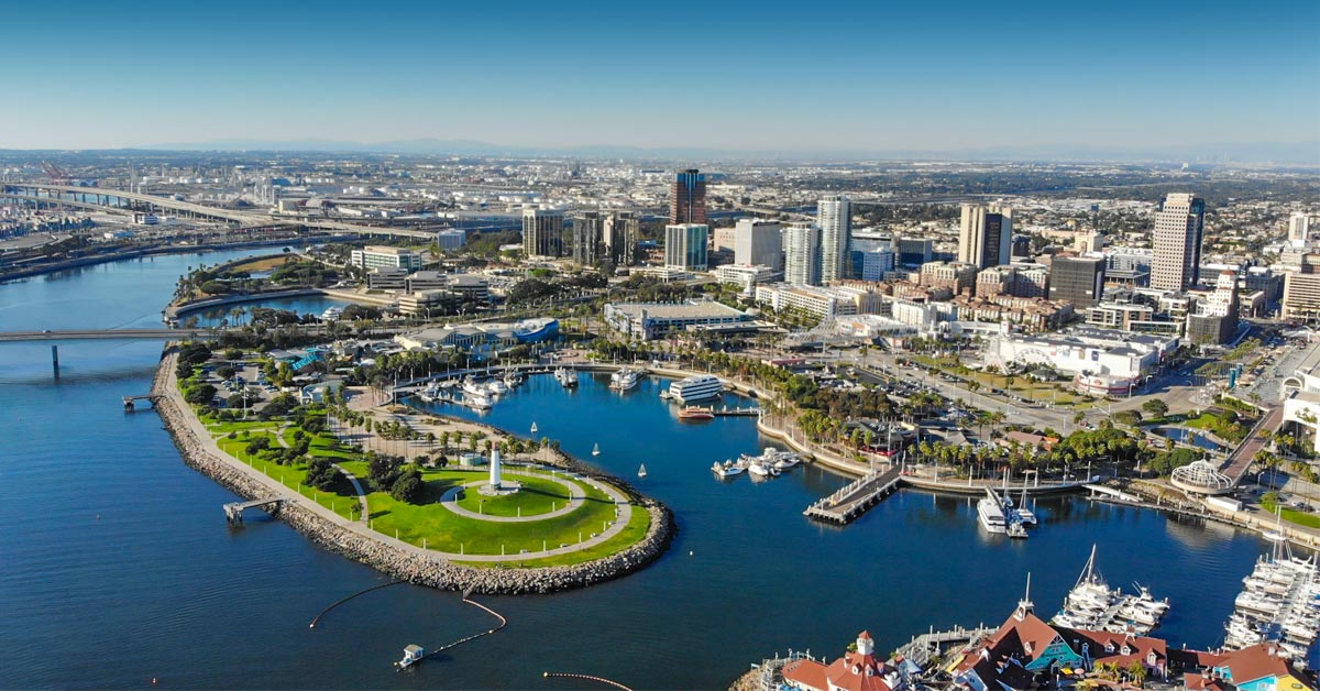
From the Port of Long Beach and Downtown Waterfront to industrial zones along Terminal Island and residential communities near Bixby Knolls, we capture Long Beach from above with accuracy and creativity.
Long Beach’s mix of maritime infrastructure, high-rise construction, and coastal real estate makes it ideal for commercial drone photography, site documentation, and LiDAR-based terrain mapping. Each mission is planned for safety, efficiency, and data quality—helping clients plan smarter and market with confidence.
High-Resolution Aerial Imaging, Topographic Mapping & LiDAR Data Collection in Long Beach, CA
Long Beach’s busy port operations, industrial facilities, and shoreline development zones require aerial mapping solutions that combine precision with scalability. AeroViews produces topographic mapping, 2D/3D models, and LiDAR surface data to support engineers, surveyors, and city planners.
From container yards and logistics hubs near Pier T to urban redevelopment projects along Ocean Boulevard, our drone teams deliver accurate, geo-referenced datasets ready for AutoCAD, Civil 3D, and GIS platforms—on time and to spec.
Ready to elevate your project with professional drone services?
Contact AeroViews today for a free quote and let’s plan your next flight in Long Beach.
A local Long Beach commercial drone services company
a few of our services
- Commercial Real Estate Drone Photography
- Commercial Real Estate Drone Videography
- Construction Site Drone Photography & Video
- Drone 3D Mapping (Orthomosaic & DSM)
- LiDAR Drone Mapping & Data Collection
- Drone Surveying Services (Photogrammetry + Topographic Mapping)
- Solar Installation Drone Photography / Video


Whatever your project, we bring it to life from above with precision aerial imaging.
From port infrastructure inspections to urban redevelopment imaging, AeroViews provides high-resolution visuals and LiDAR mapping tailored to Long Beach’s unique environment. Our workflows capture everything from site contours to panoramic marketing shots, delivering polished results you can trust.
Whether documenting expansion along Harbor Scenic Drive or surveying coastal resilience projects, our Long Beach team delivers precise spatial data and cinematic aerial content. We help clients visualize, measure, and promote every stage of development—from concept to completion.