Featured Project
LiDAR mapping and 3D terrain analysis following the September 2025 coastal bluff collapse on Marguerite Drive affecting 20 residential properties.

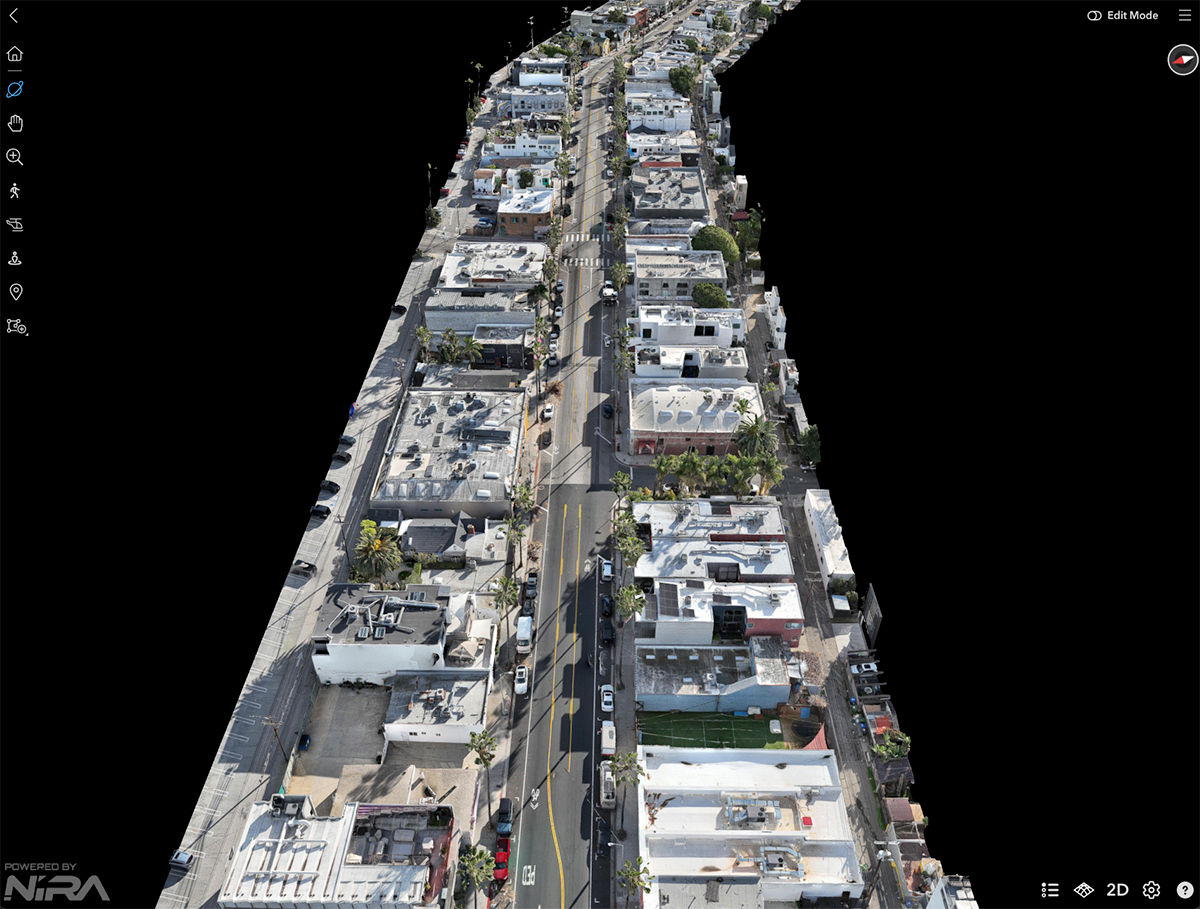
Venice Corridor LiDAR &
Photogrammetry
Urban Corridor
Area Captured
Sub-5cm
Accuracy Achieved
LiDAR + Drone
Data Collection
Data Delivery
3D Models & Point Clouds
High-resolution LiDAR and drone photogrammetry used to generate detailed point clouds and production-ready 3D models of an urban corridor in Los Angeles.
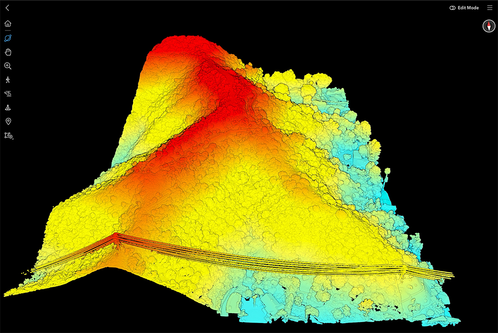
Beverly Hills LiDAR Mapping Project
15+ Acres
Area Mapped
Sub-5cm
Accuracy Achieved
48 Hours
Data Delivery
Registered
Point Cloud
Drone-based LiDAR mapping of a sloped site in Beverly Hills to generate an accurate 3D point cloud for terrain modeling and spatial analysis.
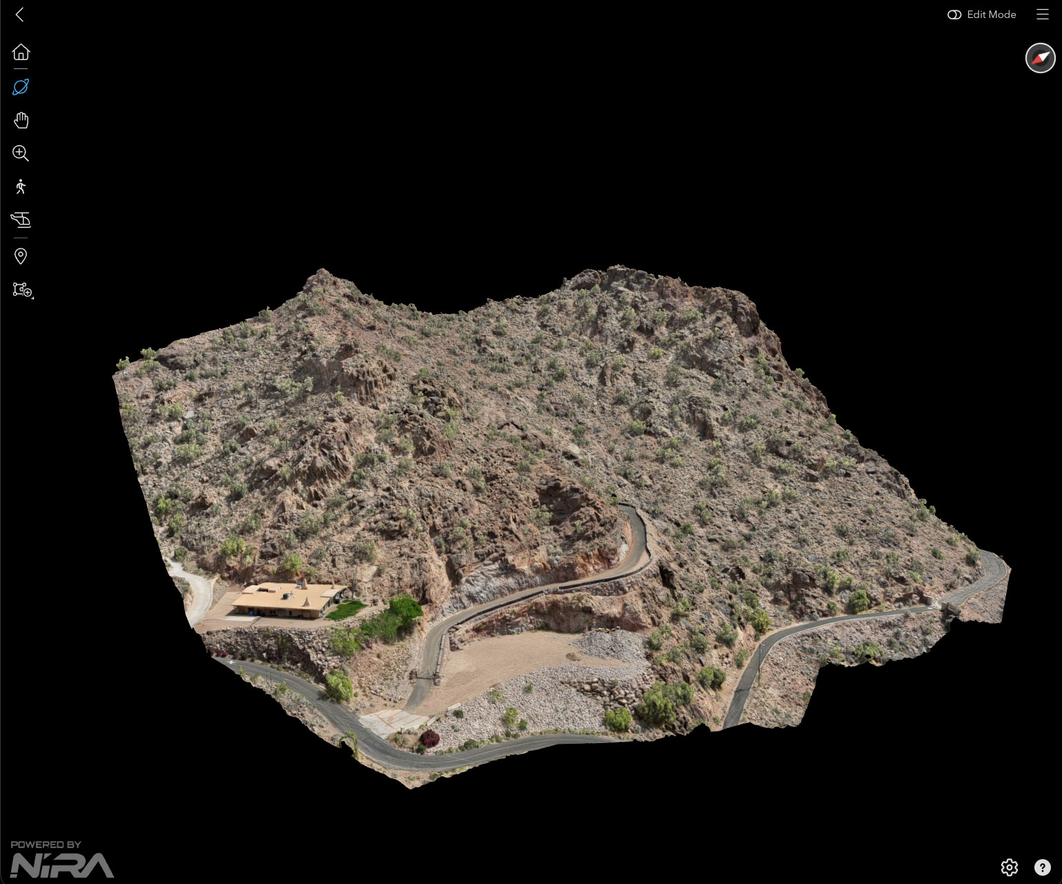
Hillside 3D Mapping & Reality Capture
Scottsdale, AZ
Hillside Mountain
Area Captured
Digital Twin
Accuracy Achieved
3D Mapping + Drone
Data Collection
Data Delivery
3D Models & Point Clouds
High-resolution 3D mapping of a Scottsdale hillside, enabling precise integration of an architectural model within a true-to-scale digital terrain.
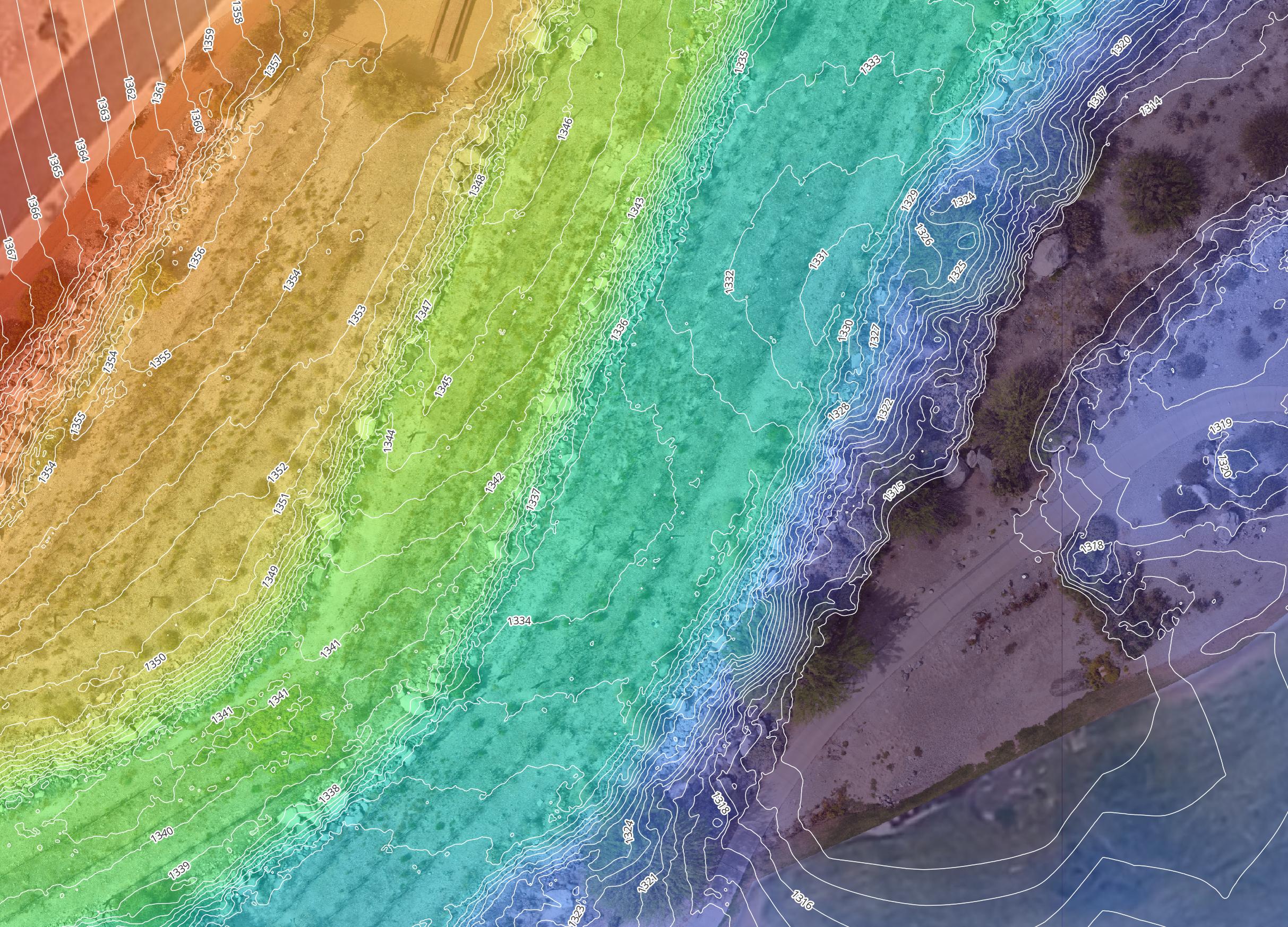
West Valley Topographic Mapping
& Terrain Modeling
5+ Acres
Area Mapped
Sub-5cm
Accuracy Achieved
24 Hours
Data Delivery
1ft & 2ft
Contours
High-accuracy aerial mapping of a 5-acre site near Verrado in Phoenix’s West Valley, delivering 1-foot contours and a design-ready terrain model for trail planning.