
What Are GIS Mapping Services?
GIS mapping services combine geographic information systems technology with spatial data collection to create detailed, layered maps that reveal patterns, relationships, and insights invisible in traditional mapping. These geospatial services transform raw location data into actionable intelligence for site analysis, resource management, and strategic planning.
At AeroViews, we provide flexible GIS mapping solutions that work with both new drone-collected data and existing datasets from government agencies, utilities, and other sources. When you need fresh, high-accuracy data, we deploy drones equipped with LiDAR sensors and high-resolution cameras. When working with existing data from County GIS systems, USDA databases, or utility records, we process, integrate, and visualize that information to create professional maps that serve as the foundation for critical business and planning decisions. This gis technology enables organizations to analyze spatial data from one location and share map data across teams for better collaboration.
Whether you need parcel boundaries for land development, utility infrastructure mapping for maintenance planning, context radius maps for planning applications, or topographic analysis for construction projects, our gis map creation services deliver the precision and detail required for professional applications. Our platform enables users to find data quickly, create dynamic maps with various data layers, and save their work in one format for easy sharing across different device types.
How GIS Technology Transforms Geospatial Data
Geographic information systems integrate a database with spatial information to create layer-based visualizations that reveal relationships between locations and data attributes. This technology allows users to analyze spatial data by overlaying various data layers, identify patterns in geographic distributions, and extract relevant information for decision-making.
Modern GIS platforms like ArcGIS Online enable organizations to create dynamic maps that update in real-time, allowing teams to share map data across departments and devices. Users can search for specific features, apply fill color schemes to represent different values, and add a new layer to incorporate additional data types. This querying capability helps organizations find relevant data quickly and make better decisions based on comprehensive spatial analysis.
The visual representation provided by GIS technology helps stakeholders understand complex spatial relationships at a glance. Whether creating a basic map for public presentation or conducting sophisticated analysis for resource allocation, GIS serves as a powerful business intelligence tool that addresses unique needs across various industries. Organizations can save their maps and page layouts, enabling consistent reporting and knowledge sharing.


 Mapping")


")


Urban Planning and Development
Municipal planners and developers rely on our land use planning maps, zoning classification maps, and parcel mapping to guide growth management. Planners can find data about existing conditions, overlay various data layers to analyze spatial relationships, and create dynamic maps that communicate planning proposals effectively.

Utilities and Infrastructure
Utility operators use our mapping services to document water, sewer, electrical, gas, and telecommunications networks. The spatial information provided enables utilities to analyze spatial data for optimal resource allocation and identify patterns in service disruptions.

Construction and Engineering
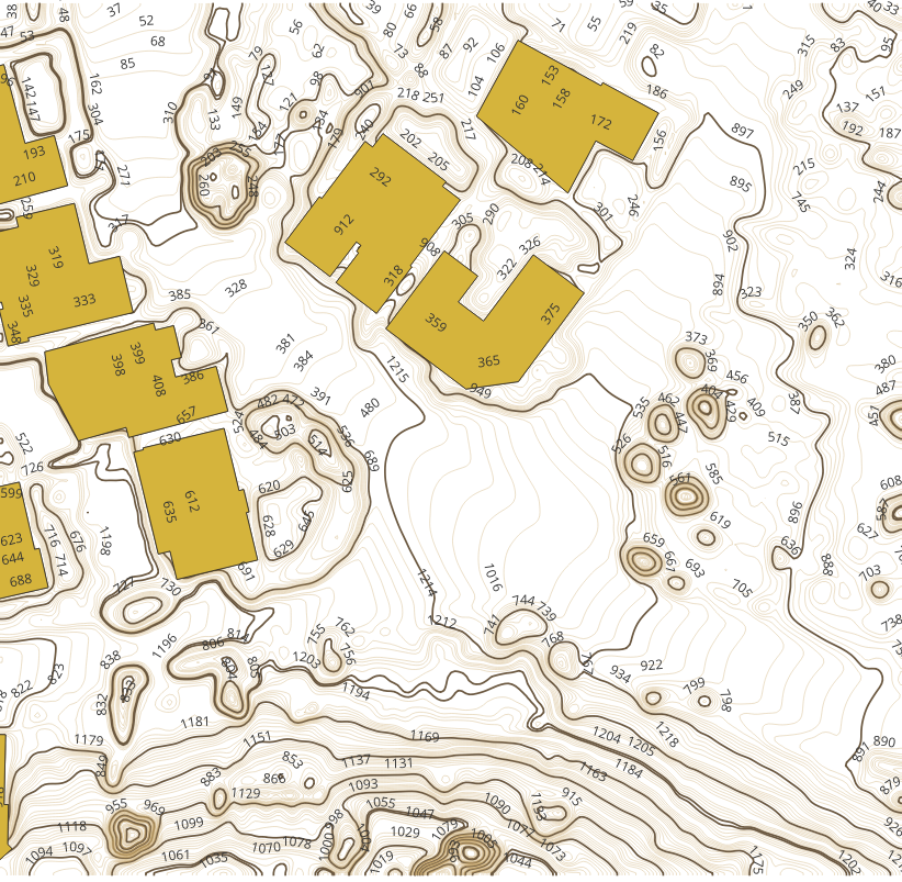
Construction firms and civil engineers depend on our topographical mapping and base mapping for site design, grading plans, and construction management. Engineers can query geospatial data to extract elevation values at specific locations and generate visual representations of proposed grading.

Real Estate and Property Management
Drones equipped with advanced imaging technologies can capture detailed and precise data, improving the accuracy of inspections. High resolution cameras and thermal sensors provide utility companies with high quality data for accurate analysis, enabling better decision making and more effective maintenance planning for electrical infrastructure.

Environmental Management
Environmental consultants and resource agencies use our LULC mapping and geological mapping to assess habitats and track land cover changes. Organizations can analyze spatial data to identify patterns in environmental change and assess threats like flood zones and earthquake-prone areas.

Government Agencies
Local, state, and federal agencies rely on our GIS mapping services for infrastructure management, emergency planning, regulatory enforcement, and public information. Government users can share map data across departments, enabling collaboration and improving service delivery.

Transportation and Logistics
Transportation agencies and logistics companies use GIS to map, analyze, and improve delivery routes to reduce fuel costs and mitigate transportation disruptions. Advanced GIS tools can simulate scenarios such as predicting traffic flow changes due to new highway constructions.
Data Collection – Drone or Existing Sources
We work with both new and existing data. For new data collection, we deploy professional-grade drones equipped with high-resolution cameras and LiDAR sensors. We also expertly process existing datasets from County GIS systems, USDA databases, planning departments, and utility companies, integrating multiple data sources into cohesive mapping products.
Data Processing and Integration
Whether working with raw drone data or existing GIS datasets, our processing workflows create accurate base layers, orthomosaic imagery, digital elevation models, and vector features. We clean, standardize, and integrate data from various sources and formats, ensuring spatial accuracy and attribute consistency across all layers.
GIS Analysis Using ArcGIS Online and Professional Platforms
Professional GIS analysts interpret processed data to extract features, classify land cover, and generate thematic maps. Maps in ArcGIS Online consist of layers, which organize and combine geographic data for comprehensive analysis. Users can add a new layer, apply fill color schemes, and save their work for later access.
Quality Assurance and Delivery
Every project undergoes comprehensive quality control including accuracy verification, attribute validation, and cartographic review. We deliver maps in multiple formats compatible with your systems (PDF, DWG, shapefile, geodatabase). Organizations can query our spatial information with confidence, knowing the underlying data meets professional standards.