


Phoenix, AZ Drone Services
Commercial Drone Photography, Drone Mapping & LiDAR
Looking for professional drone services in Phoenix, AZ? AeroViews specializes in commercial drone photography, LiDAR mapping, drone mapping, and 3D reality capture for projects across the Phoenix metro area.
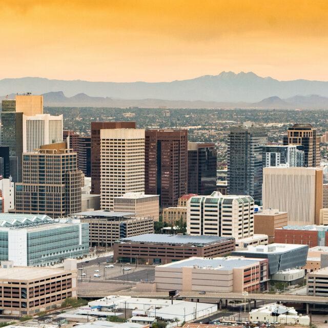
From high-rise developments in Downtown Phoenix and the Biltmore District to large-scale construction sites in North Phoenix, Deer Valley, and the rapidly expanding Desert Ridge corridor, we deliver accurate aerial data and high-impact visuals tailored to the region.
Whether you’re documenting progress on a new development in Ahwatukee Foothills, capturing commercial assets near Camelback East, or mapping land parcels on the outskirts of the Valley, our FAA-certified drone pilots provide reliable, data-driven solutions designed for Phoenix’s unique landscape and rapid growth.
High-Resolution Aerial Imaging, Topographic Mapping & LiDAR Data Collection in Phoenix, AZ
AeroViews provides advanced drone services for construction, land development, and engineering projects across Phoenix. Our core offerings include commercial drone photography, LiDAR mapping, drone mapping, and 3D reality capture, all focused on delivering accurate, actionable data.
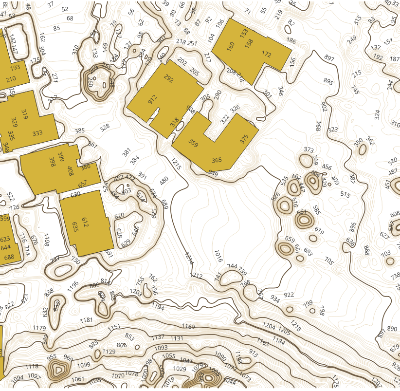
Drone Mapping, Surfaces & Contours
We specialize in generating high-accuracy surfaces, contours, and elevation models using both LiDAR and photogrammetry. These outputs support grading plans, site design, volumetric calculations, and project tracking.
From developments in North Phoenix and Deer Valley to growth near Desert Ridge and the I-17 corridor, we provide reliable data that helps teams make informed decisions.
LiDAR, Photogrammetry & 3D Capture
Our LiDAR captures detailed terrain data, while photogrammetry produces high-resolution surface models for measurement and visualization. When combined with 3D reality capture, we deliver clear, detailed models that improve planning, coordination, and communication.
We work with developers, engineers, and contractors across the Phoenix metro area who rely on accurate aerial data for fast-moving projects.
Our Phoenix drone services include:
- Commercial drone photography for construction, development, and commercial properties
- LiDAR mapping for terrain modeling, elevation data, and site analysis
- Drone mapping with photogrammetry for generating surfaces, contours, and orthomosaics
- 3D reality capture for digital twins and project visualization
- Surface models, contour maps, and volumetric analysis for grading and earthwork
- Construction progress tracking and site documentation
Ready to elevate your project with professional drone services?
Contact AeroViews today for a free quote and let’s plan your next flight in Phoenix.
A local Phoenix commercial drone services company
a few of our services
Whatever your project, we bring it to life from above with precision aerial imaging.
From early-stage planning to final delivery, AeroViews provides drone solutions that improve accuracy and efficiency across every phase of a project. Our services focus on delivering actionable data through drone mapping, LiDAR, and 3D reality capture, along with high-quality commercial drone photography.
In a fast-growing market like Phoenix, accurate surfaces, contours, and up-to-date site data are critical. Our mapping and LiDAR services help teams track progress, calculate volumes, and analyze site conditions with precision. Whether you’re working in North Phoenix, near South Mountain, or across the Valley, we deliver reliable outputs that support better decision-making.
AeroViews supports Phoenix’s growth by providing reliable drone services to developers, contractors, and engineers across the region. We specialize in drone mapping, LiDAR data collection, and 3D reality capture, delivering accurate results for planning and execution.
Our team is FAA-certified and fully insured, with experience across Downtown Phoenix, Deer Valley, and Desert Ridge. We understand the demands of large-scale projects and fast-paced timelines. As a result, we deliver consistent, high-quality data you can trust for every phase of your project.