Santa Rosa Drone Services
Santa Rosa, CA
Drone Services
AeroViews provides expert drone mapping, LiDAR mapping, and 3D reality capture services throughout Santa Rosa, CA and Sonoma County. Our FAA-certified drone operations support construction, land development, vineyards, infrastructure, and environmental projects with accurate aerial data, surfaces, contours, and detailed site models.


Santa Rosa Drone Services
Commercial Drone Photography, Drone Mapping & LiDAR
Looking for professional drone services in Santa Rosa, CA? AeroViews specializes in commercial drone photography, LiDAR mapping, drone mapping, and 3D reality capture for projects throughout Santa Rosa and Sonoma County.
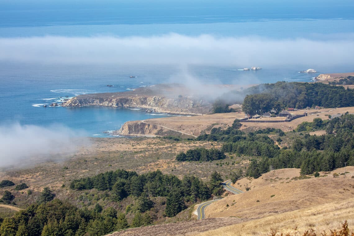
From commercial developments in Downtown Santa Rosa to vineyard properties throughout Fountaingrove, Rincon Valley, and the surrounding wine country, we deliver accurate aerial data that supports planning, construction, and long-term land management.
Whether you’re documenting construction progress, generating mapping deliverables, or capturing commercial aerial imagery, our FAA-certified drone pilots provide dependable solutions tailored to Santa Rosa’s unique terrain, growing communities, and agricultural landscape.
Commercial Drone Photography, LiDAR Mapping & 3D Reality Capture in Santa Rosa, CA
AeroViews provides advanced drone services for construction, engineering, vineyard management, and land development projects throughout Santa Rosa. Our core services include commercial drone photography, LiDAR mapping, drone mapping, and 3D reality capture, delivering accurate geospatial data and professional aerial imagery.
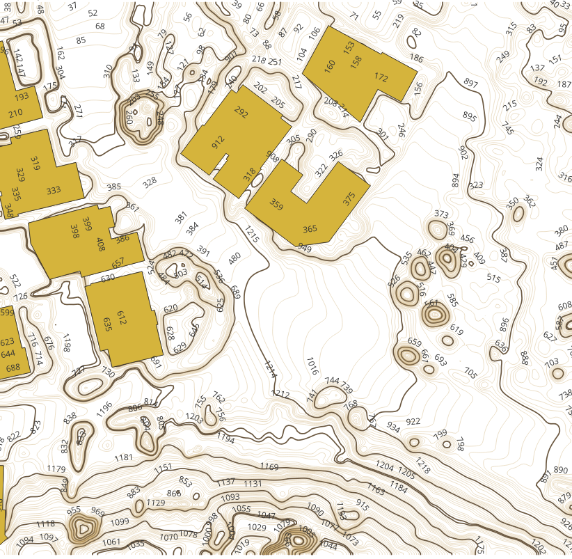
Drone Mapping, Surfaces & Contours
We generate high-accuracy surfaces, contours, elevation models, and orthomosaic maps using LiDAR and photogrammetry. These deliverables support grading plans, drainage analysis, earthwork calculations, vineyard planning, and construction progress monitoring.
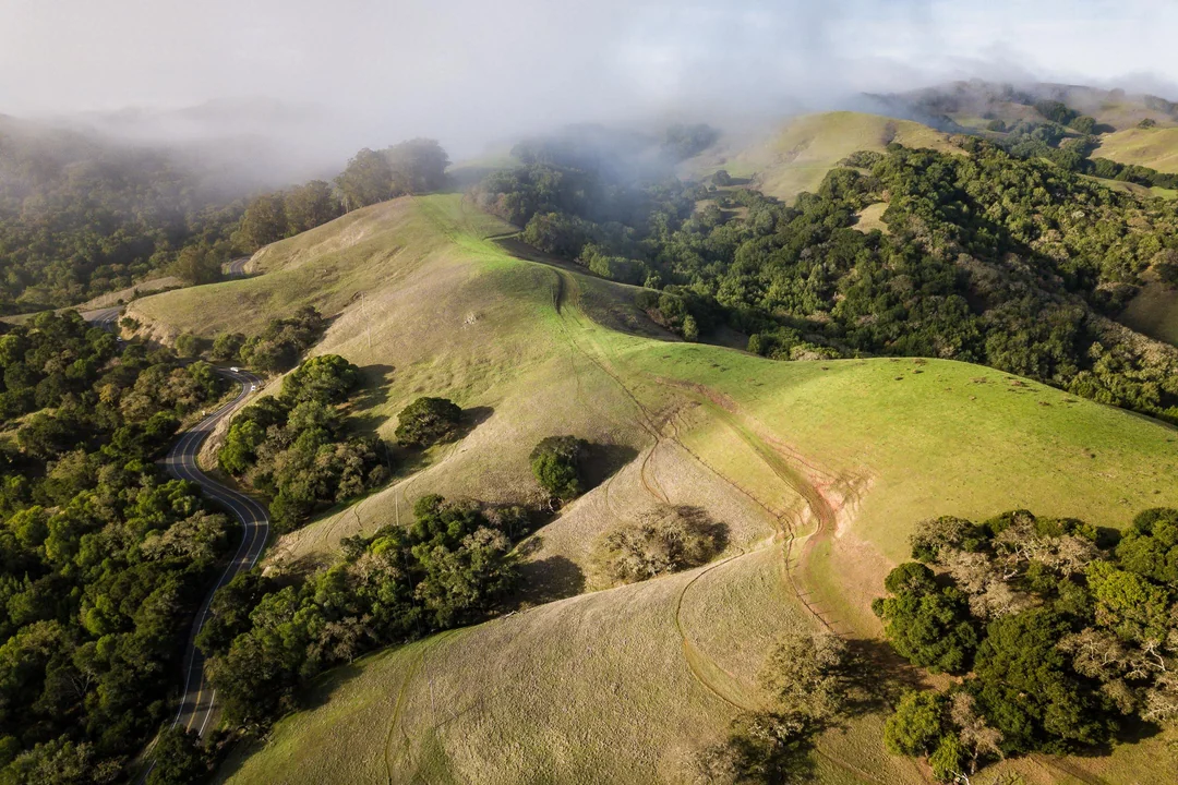
Because many projects in Santa Rosa involve rolling terrain and large rural properties, accurate mapping data is essential for planning and long-term site management.
LiDAR Mapping & Geospatial Data
Our LiDAR mapping services capture detailed terrain information across development sites, vineyards, infrastructure projects, and open space. Meanwhile, photogrammetry creates high-resolution surface models for measurement and visualization.
As a result, engineers, developers, vineyard managers, and project teams receive dependable datasets that improve planning and reduce time spent in the field.
3D Reality Capture
In addition, our 3D reality capture services create detailed digital site models that improve planning, documentation, and communication throughout every phase of a project.
Our Santa Rosa drone services include:
- Commercial drone photography
- LiDAR mapping
- Drone mapping & orthomosaics
- Surface & contour generation
- 3D reality capture & digital twins
- Volumetric calculations
- Construction progress documentation
Ready to elevate your project with professional drone services?
Contact AeroViews today for a free quote and let’s plan your next flight in Santa Rosa.
A local Santa Rosa commercial drone services company
a few of our services
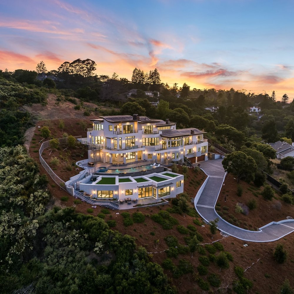
Whatever your project, we bring it to life from above with precision aerial imaging.
Accurate Drone Data for Development & Land Management
From early planning through project completion, AeroViews provides drone solutions that improve efficiency, accuracy, and communication. Our drone mapping, LiDAR, and 3D reality capture services deliver dependable data for construction, vineyards, engineering, and land development projects throughout Santa Rosa.
Whether you’re managing a commercial development, mapping vineyard terrain, or documenting infrastructure improvements, our aerial data helps reduce field time while improving project visibility and decision-making.
Trusted Drone Mapping Professionals in Santa Rosa
AeroViews supports developers, engineers, contractors, vineyard owners, and commercial property managers throughout Santa Rosa and Sonoma County. We specialize in LiDAR mapping, drone mapping, commercial drone photography, and 3D reality capture, delivering accurate aerial data for projects of every size.
Our FAA-certified team understands the challenges of hillside terrain, vineyard properties, and expanding development throughout Sonoma County. As a result, we provide reliable mapping products and professional aerial imagery that help projects stay on schedule.