San Diego Drone Photography Services
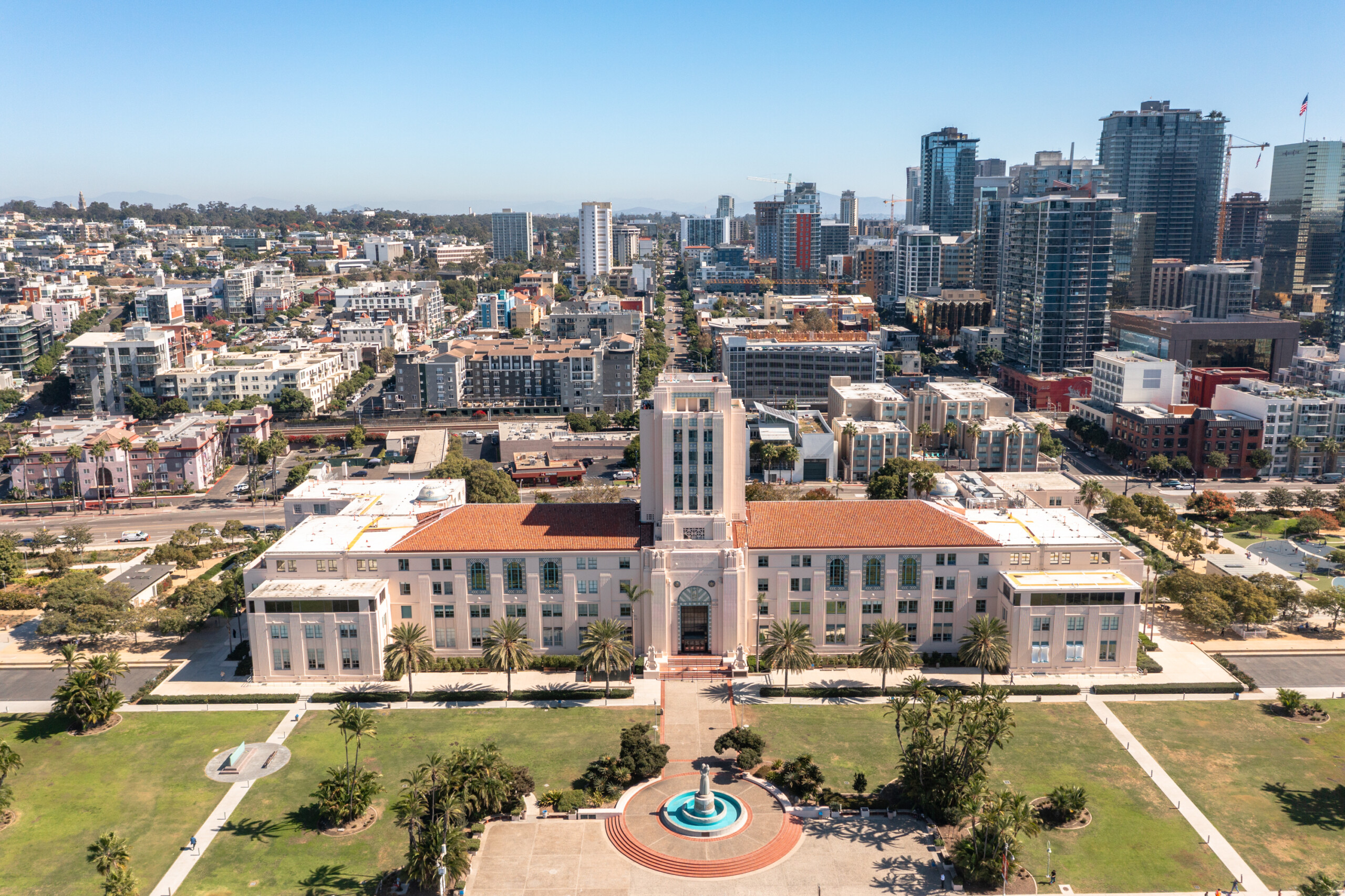
Looking for drone services in Downtown San Diego that deliver real value? Our FAA-certified pilots specialize in commercial drone photography and aerial mapping for real estate developments, construction sites, and urban land parcels. From the high-rises of East Village to the historic streets of Gaslamp Quarter, we bring every angle of downtown into focus with cinematic clarity and photogrammetric accuracy.
Whether it’s documenting a rooftop renovation near Petco Park or producing aerial visuals for a marketing campaign on Broadway, AeroViews delivers fast, high-resolution drone imagery you can count on.
High-Resolution Aerial Imaging, Topographic Mapping & LiDAR Data Collection in San Diego, CA
Downtown San Diego’s skyline, waterfront development, and dense commercial zones require precision aerial imaging and AeroViews delivers. Our FAA-certified drone pilots provide high-resolution visuals and detailed mapping to meet the needs of developers, architects, and commercial real estate professionals.
Whether you’re documenting parcels near the Gaslamp Quarter, capturing marketing assets along the Embarcadero, or mapping structures in the East Village, we deliver survey-grade data and cinematic imagery with accuracy, speed, and local expertise.
Our drone services in Downtown San Diego include topographic mapping, LiDAR data collection, photogrammetry, and high-resolution photography. Every project begins with a custom flight plan and no-obligation estimate. We also serve adjacent neighborhoods including Bankers Hill, Little Italy, and Harborview.
Ready to elevate your project with professional drone services?
Contact AeroViews today for a free quote and let’s plan your next flight in San Diego.
A local San Diego commercial drone services company
a few of our services
- Commercial Real Estate Drone Photography
- Commercial Real Estate Drone Videography
- Construction Site Drone Photography & Video
- Drone 3D Mapping (Orthomosaic & DSM)
- LiDAR Drone Mapping & Data Collection
- Drone Surveying Services (Photogrammetry + Topographic Mapping)
- Solar Installation Drone Photography / Video
Whatever your project, we bring it to life from above with precision aerial imaging.
Whether you’re capturing skyline views from high-rises in the Gaslamp Quarter, mapping construction zones near Petco Park, or documenting commercial renovations in the Marina District, our drone team brings years of technical and cinematic expertise to every mission. We blend stunning aerial visuals with accurate spatial data to elevate your marketing, planning, and development efforts.
No site is too complex or too vertical. From FAA-compliant LiDAR mapping to high-end commercial real estate videography, AeroViews helps architects, developers, and marketers gain clarity and control. Let’s bring precision and impact to your Downtown San Diego project—one flight at a time.