
Dodger Stadium 3D Reality Capture & LiDAR Mapping
AeroViews completed a high-resolution drone LiDAR and photogrammetry mission at Dodger Stadium to create an engineering-grade digital representation of one of the world’s most iconic sports venues. The resulting dataset delivers accurate terrain, structures, and stadium geometry for visualization, planning, and asset documentation.
1 Day
Project Completion
100M+
Points Captured
Delivery
3D Model
3D Modeling
DSM
DEM
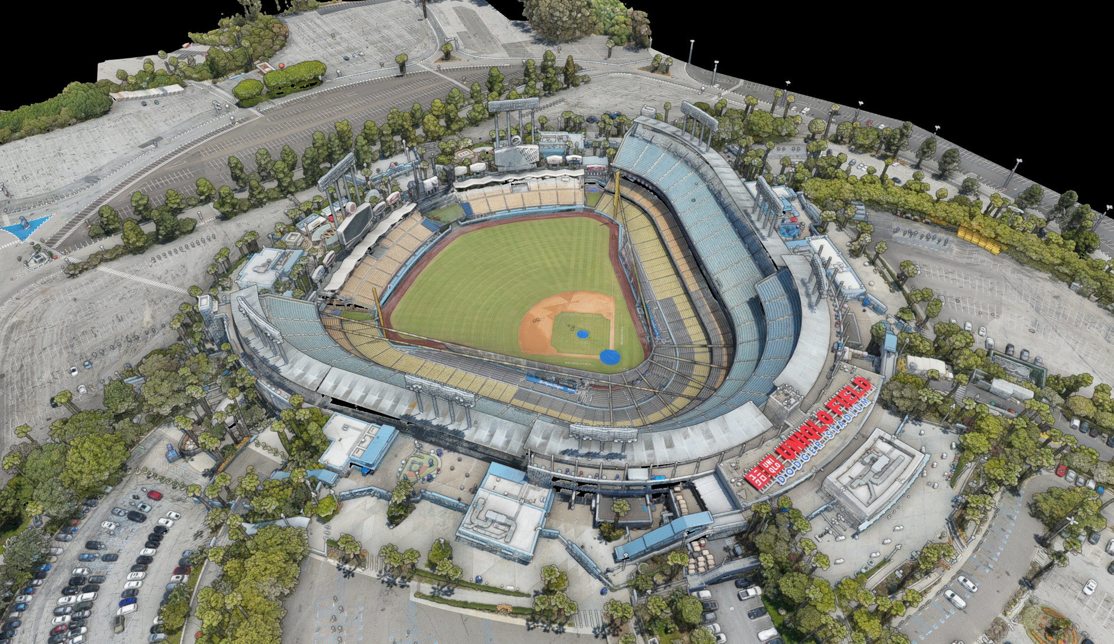
Engineering Grade Spatial Data
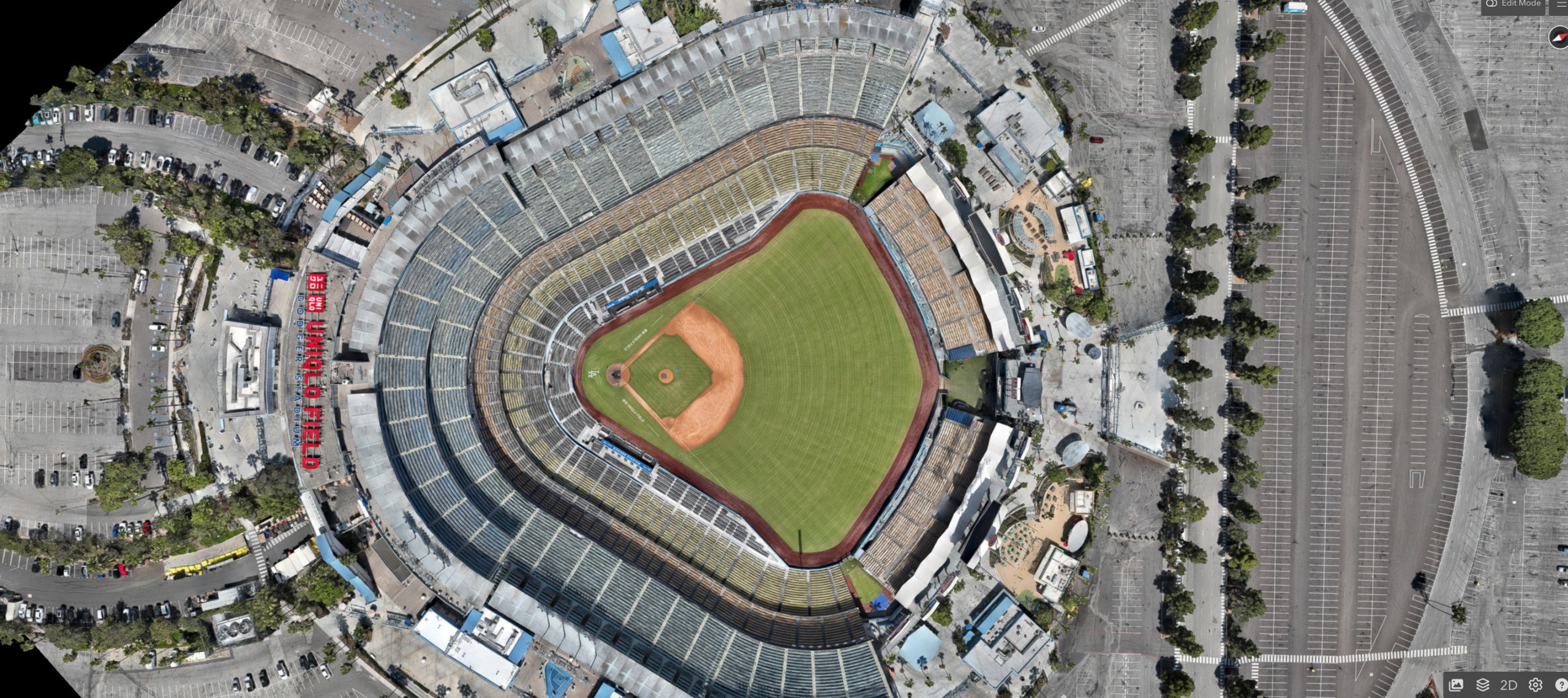
The captured LiDAR and photogrammetry data were processed into a comprehensive digital dataset, including high-density point clouds, terrain models, orthomosaics, and an interactive 3D model suitable for engineering, GIS, CAD, and visualization workflows.
Project Overview
AeroViews was commissioned to perform a comprehensive aerial reality capture of Dodger Stadium using advanced drone LiDAR and photogrammetry. The objective was to create a highly accurate digital twin capable of documenting the stadium’s complex architecture, surrounding infrastructure, parking areas, and terrain.
Multiple aerial missions were flown to maximize coverage while maintaining consistent overlap and point density throughout the site. The collected data was processed into a dense point cloud and detailed 3D model, preserving structural geometry and elevation with engineering-grade accuracy.
The resulting dataset provides a scalable digital asset that can be used for visualization, planning, facility management, engineering, and future renovation projects.
Deliverables
Technical Services



Results & Impact
The completed reality capture produced a highly accurate digital representation of Dodger Stadium, allowing stakeholders to visualize, measure, and analyze the facility without relying solely on field visits.
The engineering-grade dataset establishes a permanent digital record that supports planning, maintenance, future renovations, and infrastructure management while significantly improving project efficiency.