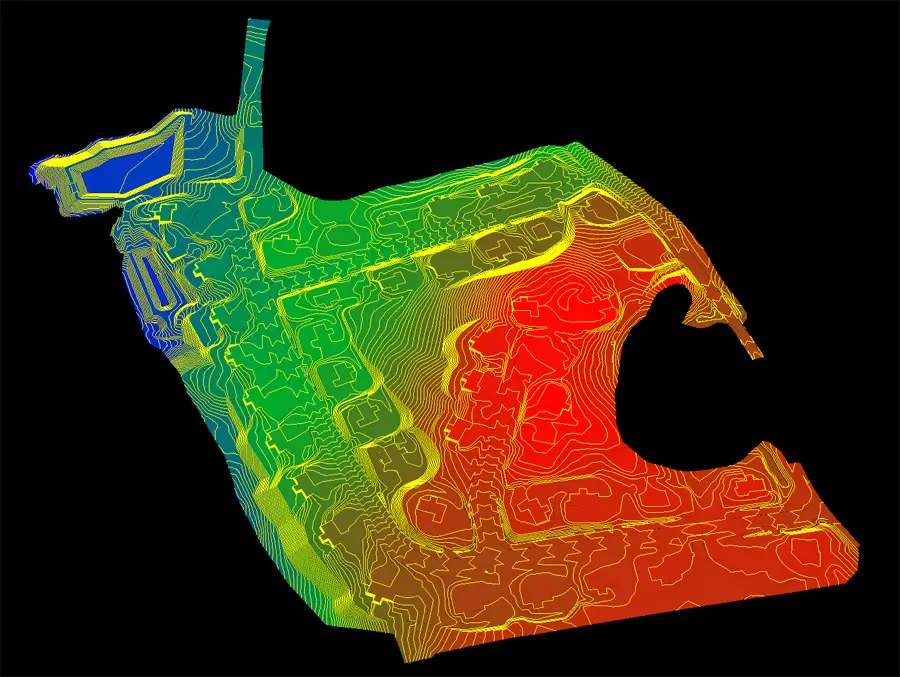
How Drone LiDAR Data Becomes a Trimble Machine Control Model
Step 1: High-Accuracy Drone & LiDAR Data Capture Before you can build a Trimble machine control model, you need accurate ground data. This is
Step 1: High-Accuracy Drone & LiDAR Data Capture Before you can build a Trimble machine control model, you need accurate ground data. This is
Why Ground Control Points Still Matter in Modern Drone Surveying Drones have revolutionized land surveying, offering faster data collection, real-time insights, and scalable workflows.
Control points in surveying are precisely measured reference locations used to anchor all other measurements to real-world geographic coordinates. These are physical spots —
The Emlid RS3 is a high-precision, multi-band GNSS receiver designed for professional applications like surveying, construction layout, and precision agriculture. What makes it stand
What is Aerial Mapping? Aerial mapping is the process of collecting geospatial data from above to create high-resolution maps, 3D models, and terrain analysis.
What Is Drone Surveying and How Accurate Is It? If you have ever found yourself wondering how accurate is a drone survey, this blog
The Growing Demand for Drone Photography Drone photography has rapidly grown in demand across industries such as real estate, construction, weddings, commercial marketing, and
Flying a drone outdoors while operating it from inside your house presents an interesting combination of convenience and challenges. Whether due to weather conditions,
Drones have revolutionized industries like photography, surveying, and delivery. Their ability to access hard-to-reach areas and provide stunning aerial views has made them indispensable
Construction drone services are not just a technological upgrade; they are transforming the landscape of construction management and oversight in construction projects.

© Copyright 2012 – 2026 | AeroViews LLC | All Rights Reserved


